Buttisholz geodata
Buttisholz (Lucerne) is a populated place; located in Switzerland in Europe/Zurich (GMT+2) time zone. With population of 2,890 people, there are 607 cities with bigger population in this country. Compared to other cities in Switzerland, 58.4% of cities are located further ↑North; 58% of cities are located further →East and 68.9% of cities have lower elevation than Buttisholz. Note1


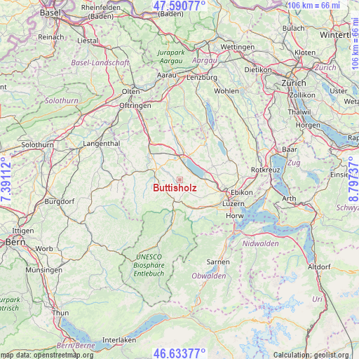
Buttisholz GPS coordinates[2]
47° 6' 51.912" North, 8° 5' 39.3" East
| Map corner | latitude | longitude |
|---|---|---|
| Upper-left | 47.59077°, | 7.39112° |
| Center: | 47.11442°, | 8.09425° |
| Lower-right: | 46.63377°, | 8.79737° |
| Map W x H: | 106.4×106.4 km | = 66.1×66.1mi |
| max Lat: | 47.76737° ⇑58.4% North |
| Buttisholz: | 47.11442° |
| min Lat: | ⇓41.6% South 45.83203° |
| min Long | Buttisholz | max Long |
| 5.97153° | 8.09425° | 10.44624° |
| W 42%⇐ | ⇒58% E |
Elevation
Elevation of Buttisholz is 567 m = 1860 ft, and this is 8.8 m = 29 ft above average elevation for this country.
| Max E: |
1845 m = 6053 ft | 31.1% |
| Buttisholz | 567 m 1860 ft | |
| Avg. | 558.2 m = 1831 ft | |
Min E: |
197 m = 646 ft | 68.9% |
See also: Switzerland elevation on elevation.city.
Geographical zone
Buttisholz is located in North temperate zone (between Tropic of Cancer and the Arctic Circle). Distance of this North polar circle is 2162.5 km =1343.7 mi to North.| Distance of | km | miles | from Buttisholz |
|---|---|---|---|
| North Pole | 4768.4 | 2962.9 | to North |
| Arctic Circle | 2162.5 | 1343.7 | to North |
| Tropic Cancer | 2632.7 | 1635.9 | to South |
| Equator | 5238.6 | 3255.1 | to South |


Nearby cities:
15 places around Buttisholz: (largest is in red/bold)
• Alberswil
7.9 km =4.9 mi,  299°
299°
• Eich
6.9 km =4.3 mi,  53°
53°
• Ettiswil
7 km =4.3 mi, 304°
• Grosswangen
3.9 km =2.4 mi, 302°
• Mauensee
6.2 km =3.9 mi,  341°
341°
• Menznau
5.4 km =3.4 mi,  230°
230°
• Nottwil
4 km =2.5 mi,  55°
55°
• Oberkirch
4.9 km =3 mi,  19°
19°
• Ruswil
4.1 km =2.5 mi,  144°
144°
• Schenkon
7.6 km =4.7 mi, 22°
• Sempach
7.7 km =4.8 mi,  72°
72°
• Sursee
6.4 km =4 mi,  11°
11°
• Werthenstein
6.5 km =4 mi,  174°
174°
• Willisau
7.6 km =4.7 mi,  276°
276°
• Wolhusen
6.3 km =3.9 mi,  194°
194°
Sources, notices
• [Note1] Compared only with cities in Switzerland existing in our database
• [Src1] Map data: © OpenStreetMap contributors (CC-BY-SA)
• [Src2] Other city data from geonames.org with taken over terms of usage.
• [Src3] Geographical zone / Annual Mean Temperature by Robert A. Rohde @ Wikipedia
