Wolhusen geodata
Wolhusen (Lucerne) is a populated place; located in Switzerland in Europe/Zurich (GMT+2) time zone. With population of 4,050 people, there are 432 cities with bigger population in this country. Compared to other cities in Switzerland, 61% of cities are located further ↑North; 58.5% of cities are located further →East and 71.9% of cities have lower elevation than Wolhusen. Note1


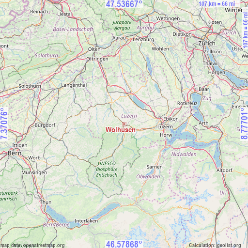
Wolhusen GPS coordinates[2]
47° 3' 35.388" North, 8° 4' 26.004" East
| Map corner | latitude | longitude |
|---|---|---|
| Upper-left | 47.53667°, | 7.37076° |
| Center: | 47.05983°, | 8.07389° |
| Lower-right: | 46.57868°, | 8.77701° |
| Map W x H: | 106.5×106.5 km | = 66.2×66.2mi |
| max Lat: | 47.76737° ⇑61% North |
| Wolhusen: | 47.05983° |
| min Lat: | ⇓39% South 45.83203° |
| min Long | Wolhusen | max Long |
| 5.97153° | 8.07389° | 10.44624° |
| W 41.5%⇐ | ⇒58.5% E |
Elevation
Elevation of Wolhusen is 586 m = 1923 ft, and this is 27.8 m = 91 ft above average elevation for this country.
| Max E: |
1845 m = 6053 ft | 28.1% |
| Wolhusen | 586 m 1923 ft | |
| Avg. | 558.2 m = 1831 ft | |
Min E: |
197 m = 646 ft | 71.9% |
See also: Switzerland elevation on elevation.city.
Geographical zone
Wolhusen is located in North temperate zone (between Tropic of Cancer and the Arctic Circle). Distance of this North polar circle is 2168.6 km =1347.5 mi to North.| Distance of | km | miles | from Wolhusen |
|---|---|---|---|
| North Pole | 4774.5 | 2966.7 | to North |
| Arctic Circle | 2168.6 | 1347.5 | to North |
| Tropic Cancer | 2626.6 | 1632.1 | to South |
| Equator | 5232.6 | 3251.4 | to South |


Nearby cities:
15 places around Wolhusen: (largest is in red/bold)
• Buttisholz
6.3 km =3.9 mi,  14°
14°
• Doppleschwand
4.8 km =3 mi,  197°
197°
• Entlebuch
7.2 km =4.5 mi,  186°
186°
• Ettiswil
10.9 km =6.8 mi,  337°
337°
• Grosswangen
8.3 km =5.2 mi,  347°
347°
• Hasle
9.2 km =5.7 mi, 189°
• Malters
8.6 km =5.3 mi,  107°
107°
• Menznau
3.7 km =2.3 mi,  315°
315°
• Neuenkirch
10.8 km =6.7 mi,  65°
65°
• Nottwil
9.6 km =6 mi,  30°
30°
• Oberkirch
11.2 km =7 mi,  16°
16°
• Ruswil
4.8 km =3 mi,  55°
55°
• Schwarzenberg
8.9 km =5.5 mi,  122°
122°
• Werthenstein
2.2 km =1.4 mi,  102°
102°
• Willisau
9.2 km =5.7 mi, 318°
Sources, notices
• [Note1] Compared only with cities in Switzerland existing in our database
• [Src1] Map data: © OpenStreetMap contributors (CC-BY-SA)
• [Src2] Other city data from geonames.org with taken over terms of usage.
• [Src3] Geographical zone / Annual Mean Temperature by Robert A. Rohde @ Wikipedia
