Oberglatt / Bellen-Grafschaft geodata
Oberglatt / Bellen-Grafschaft (Zurich) is a section of populated place; located in Switzerland in Europe/Zurich (GMT+2) time zone. With population of 825 people, there are 1476 cities with bigger population in this country. Compared to other cities in Switzerland, 86.2% of cities are located further ↓South; 59% of cities are located further ←West and 75.9% of cities have higher elevation than Oberglatt / Bellen-Grafschaft. Note1
Current local time in Oberglatt / Bellen-Grafschaft:
07:40 AM, SaturdayDifference from your time zone: hours


Oberglatt / Bellen-Grafschaft GPS coordinates[2]
47° 28' 47.64" North, 8° 31' 28.956" East
| Map corner | latitude | longitude |
|---|---|---|
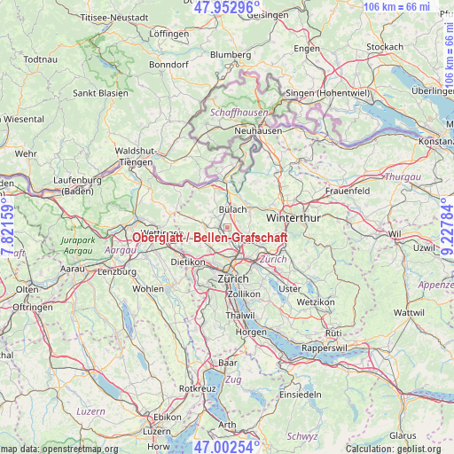
| Upper-left | 47.95296°, | 7.82159° |
| Center: | 47.4799°, | 8.52471° |
| Lower-right: | 47.00254°, | 9.22784° |
| Map W x H: | 105.7×105.7 km | = 65.7×65.7mi |
| max Lat: | 47.76737° ⇑13.8% North |
| Oberglatt / Bellen-Grafschaft: | 47.4799° |
| min Lat: | ⇓86.2% South 45.83203° |
| min Long | Oberglatt / Bel | max Long |
| 5.97153° | 8.52471° | 10.44624° |
| W 59%⇐ | ⇒41% E |
Elevation
Elevation of Oberglatt / Bellen-Grafschaft is 430 m = 1411 ft, and this is 128.2 m = 421 ft below average elevation for this country.
| Max E: |
1845 m = 6053 ft | 75.9% |
| Avg. | 558.2 m = 1831 ft | |
| Oberglatt / Bellen-Grafschaft | 430 m = 1411 ft | |
Min E: |
197 m = 646 ft | 24.1% |
See also: Switzerland elevation on elevation.city.
Geographical zone
Oberglatt / Bellen-Grafschaft is located in North temperate zone (between Tropic of Cancer and the Arctic Circle). Distance of this North polar circle is 2121.9 km =1318.5 mi to North.| Distance of | km | miles | from Oberglatt / Bellen-Grafschaft |
|---|---|---|---|
| North Pole | 4727.8 | 2937.7 | to North |
| Arctic Circle | 2121.9 | 1318.5 | to North |
| Tropic Cancer | 2673.4 | 1661.2 | to South |
| Equator | 5279.3 | 3280.4 | to South |


Nearby cities:
15 places around Oberglatt / Bellen-Grafschaft: (largest is in red/bold)
• Bachenbülach
3 km =1.9 mi,  31°
31°
• Bückler-Dörnler
3.2 km =2 mi,  347°
347°
• Hofstetten
1.4 km =0.9 mi,  260°
260°
• Niederglatt
2.2 km =1.4 mi,  302°
302°
• Niederglatt / Grafschaft
2.3 km =1.4 mi,  314°
314°
• Niederglatt / Niederglatt (Dorfkern)
2.2 km =1.4 mi, 303°
• Niederglatt / Nöschikon
2.8 km =1.7 mi, 307°
• Niederhasli
2.9 km =1.8 mi,  270°
270°
• Oberglatt
0.6 km =0.4 mi,  223°
223°
• Oberglatt / Bahnhofquartier
1.3 km =0.8 mi, 223°
• Oberglatt / Oberglatt (Dorfkern)
0.6 km =0.4 mi, 222°
• Oberhasli / Birch
2.1 km =1.3 mi,  237°
237°
• Rümlang
3.3 km =2.1 mi,  173°
173°
• Rümlang / Säntisstrasse-Aegler
3 km =1.9 mi,  177°
177°
• Winkel
2.6 km =1.6 mi,  58°
58°
Sources, notices
• [Note1] Compared only with cities in Switzerland existing in our database
• [Src1] Map data: © OpenStreetMap contributors (CC-BY-SA)
• [Src2] Other city data from geonames.org with taken over terms of usage.
• [Src3] Geographical zone / Annual Mean Temperature by Robert A. Rohde @ Wikipedia
