Oberglatt / Bahnhofquartier geodata
Oberglatt / Bahnhofquartier (Zurich) is a section of populated place; located in Switzerland in Europe/Zurich (GMT+2) time zone. With population of 1,333 people, there are 1113 cities with bigger population in this country. Compared to other cities in Switzerland, 85.2% of cities are located further ↓South; 57.5% of cities are located further ←West and 76.6% of cities have higher elevation than Oberglatt / Bahnhofquartier. Note1
Current local time in Oberglatt / Bahnhofquartier:
08:53 AM, SaturdayDifference from your time zone: hours


Oberglatt / Bahnhofquartier GPS coordinates[2]
47° 28' 17.148" North, 8° 30' 46.404" East
| Map corner | latitude | longitude |
|---|---|---|
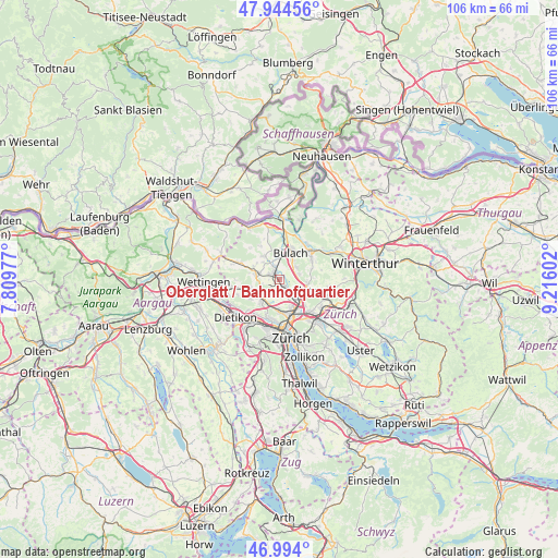
| Upper-left | 47.94456°, | 7.80977° |
| Center: | 47.47143°, | 8.51289° |
| Lower-right: | 46.994°, | 9.21602° |
| Map W x H: | 105.7×105.7 km | = 65.7×65.7mi |
| max Lat: | 47.76737° ⇑14.8% North |
| Oberglatt / Bahnhofquartier: | 47.47143° |
| min Lat: | ⇓85.2% South 45.83203° |
| min Long | Oberglatt / Bah | max Long |
| 5.97153° | 8.51289° | 10.44624° |
| W 57.5%⇐ | ⇒42.5% E |
Elevation
Elevation of Oberglatt / Bahnhofquartier is 428 m = 1404 ft, and this is 130.2 m = 427 ft below average elevation for this country.
| Max E: |
1845 m = 6053 ft | 76.6% |
| Avg. | 558.2 m = 1831 ft | |
| Oberglatt / Bahnhofquartier | 428 m = 1404 ft | |
Min E: |
197 m = 646 ft | 23.4% |
See also: Switzerland elevation on elevation.city.
Geographical zone
Oberglatt / Bahnhofquartier is located in North temperate zone (between Tropic of Cancer and the Arctic Circle). Distance of this North polar circle is 2122.8 km =1319 mi to North.| Distance of | km | miles | from Oberglatt / Bahnhofquartier |
|---|---|---|---|
| North Pole | 4728.7 | 2938.3 | to North |
| Arctic Circle | 2122.8 | 1319 | to North |
| Tropic Cancer | 2672.4 | 1660.6 | to South |
| Equator | 5278.3 | 3279.8 | to South |


Nearby cities:
15 places around Oberglatt / Bahnhofquartier: (largest is in red/bold)
• Hofstetten
0.9 km =0.6 mi,  325°
325°
• Niederglatt
2.4 km =1.5 mi,  335°
335°
• Niederglatt / Grafschaft
2.6 km =1.6 mi, 343°
• Niederglatt / Niederglatt (Dorfkern)
2.3 km =1.4 mi, 336°
• Niederglatt / Nöschikon
3 km =1.9 mi, 332°
• Niederhasli
2.3 km =1.4 mi,  295°
295°
• Oberglatt
0.7 km =0.4 mi,  43°
43°
• Oberglatt / Bellen-Grafschaft
1.3 km =0.8 mi, 43°
• Oberglatt / Oberglatt (Dorfkern)
0.7 km =0.4 mi, 43°
• Oberhasli / Birch
0.9 km =0.6 mi,  256°
256°
• Rümlang
2.7 km =1.7 mi,  151°
151°
• Rümlang / Huebacher
3 km =1.9 mi,  160°
160°
• Rümlang / Rümlang (Dorfkern)
2.9 km =1.8 mi, 148°
• Rümlang / Säntisstrasse-Aegler
2.3 km =1.4 mi, 154°
• Winkel
3.8 km =2.4 mi,  53°
53°
Sources, notices
• [Note1] Compared only with cities in Switzerland existing in our database
• [Src1] Map data: © OpenStreetMap contributors (CC-BY-SA)
• [Src2] Other city data from geonames.org with taken over terms of usage.
• [Src3] Geographical zone / Annual Mean Temperature by Robert A. Rohde @ Wikipedia
