Oberhasli / Birch geodata
Oberhasli / Birch (Zurich) is a section of populated place; located in Switzerland in Europe/Zurich (GMT+2) time zone. With population of 858 people, there are 1449 cities with bigger population in this country. Compared to other cities in Switzerland, 84.8% of cities are located further ↓South; 56.9% of cities are located further ←West and 67.1% of cities have higher elevation than Oberhasli / Birch. Note1


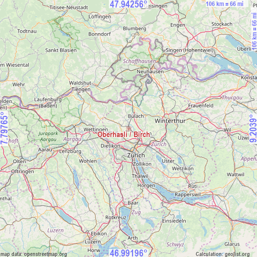
Oberhasli / Birch GPS coordinates[2]
47° 28' 9.876" North, 8° 30' 2.808" East
| Map corner | latitude | longitude |
|---|---|---|
| Upper-left | 47.94256°, | 7.79765° |
| Center: | 47.46941°, | 8.50078° |
| Lower-right: | 46.99196°, | 9.2039° |
| Map W x H: | 105.7×105.7 km | = 65.7×65.7mi |
| max Lat: | 47.76737° ⇑15.2% North |
| Oberhasli / Birch: | 47.46941° |
| min Lat: | ⇓84.8% South 45.83203° |
| min Long | Oberhasli / Bir | max Long |
| 5.97153° | 8.50078° | 10.44624° |
| W 56.9%⇐ | ⇒43.1% E |
Elevation
Elevation of Oberhasli / Birch is 442 m = 1450 ft, and this is 116.2 m = 381 ft below average elevation for this country.
| Max E: |
1845 m = 6053 ft | 67.1% |
| Avg. | 558.2 m = 1831 ft | |
| Oberhasli / Birch | 442 m = 1450 ft | |
Min E: |
197 m = 646 ft | 32.9% |
See also: Switzerland elevation on elevation.city.
Geographical zone
Oberhasli / Birch is located in North temperate zone (between Tropic of Cancer and the Arctic Circle). Distance of this North polar circle is 2123.1 km =1319.2 mi to North.| Distance of | km | miles | from Oberhasli / Birch |
|---|---|---|---|
| North Pole | 4729 | 2938.5 | to North |
| Arctic Circle | 2123.1 | 1319.2 | to North |
| Tropic Cancer | 2672.2 | 1660.4 | to South |
| Equator | 5278.1 | 3279.7 | to South |


Nearby cities:
15 places around Oberhasli / Birch: (largest is in red/bold)
• Hofstetten
1 km =0.6 mi,  24°
24°
• Laubisser
3 km =1.9 mi,  217°
217°
• Niederglatt
2.4 km =1.5 mi,  358°
358°
• Niederglatt / Grafschaft
2.8 km =1.7 mi,  3°
3°
• Niederglatt / Niederglatt (Dorfkern)
2.4 km =1.5 mi, 359°
• Niederglatt / Nöschikon
2.9 km =1.8 mi,  350°
350°
• Niederhasli
1.6 km =1 mi,  316°
316°
• Oberglatt
1.5 km =0.9 mi,  62°
62°
• Oberglatt / Bahnhofquartier
0.9 km =0.6 mi,  76°
76°
• Oberglatt / Bellen-Grafschaft
2.1 km =1.3 mi, 57°
• Oberglatt / Oberglatt (Dorfkern)
1.6 km =1 mi, 62°
• Rümlang
3 km =1.9 mi,  133°
133°
• Rümlang / Huebacher
3.3 km =2.1 mi,  144°
144°
• Rümlang / Rümlang (Dorfkern)
3.3 km =2.1 mi, 132°
• Rümlang / Säntisstrasse-Aegler
2.7 km =1.7 mi, 133°
Sources, notices
• [Note1] Compared only with cities in Switzerland existing in our database
• [Src1] Map data: © OpenStreetMap contributors (CC-BY-SA)
• [Src2] Other city data from geonames.org with taken over terms of usage.
• [Src3] Geographical zone / Annual Mean Temperature by Robert A. Rohde @ Wikipedia
