Sand geodata
Sand (Zurich) is a populated place; located in Switzerland in Europe/Zurich (GMT+2) time zone. With population of 879 people, there are 1433 cities with bigger population in this country. Compared to other cities in Switzerland, 80.9% of cities are located further ↓South; 55.7% of cities are located further ←West and 67.9% of cities have higher elevation than Sand. Note1


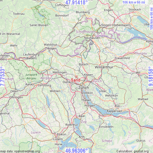
Sand GPS coordinates[2]
47° 26' 26.772" North, 8° 28' 42.456" East
| Map corner | latitude | longitude |
|---|---|---|
| Upper-left | 47.91418°, | 7.77533° |
| Center: | 47.44077°, | 8.47846° |
| Lower-right: | 46.96306°, | 9.18158° |
| Map W x H: | 105.8×105.8 km | = 65.7×65.7mi |
| max Lat: | 47.76737° ⇑19.1% North |
| Sand: | 47.44077° |
| min Lat: | ⇓80.9% South 45.83203° |
| min Long | Sand | max Long |
| 5.97153° | 8.47846° | 10.44624° |
| W 55.7%⇐ | ⇒44.3% E |
Elevation
Elevation of Sand is 441 m = 1447 ft, and this is 117.2 m = 385 ft below average elevation for this country.
| Max E: |
1845 m = 6053 ft | 67.9% |
| Avg. | 558.2 m = 1831 ft | |
| Sand | 441 m = 1447 ft | |
Min E: |
197 m = 646 ft | 32.1% |
See also: Switzerland elevation on elevation.city.
Geographical zone
Sand is located in North temperate zone (between Tropic of Cancer and the Arctic Circle). Distance of this North polar circle is 2126.3 km =1321.2 mi to North.| Distance of | km | miles | from Sand |
|---|---|---|---|
| North Pole | 4732.1 | 2940.4 | to North |
| Arctic Circle | 2126.3 | 1321.2 | to North |
| Tropic Cancer | 2669 | 1658.4 | to South |
| Equator | 5274.9 | 3277.7 | to South |


Nearby cities:
15 places around Sand: (largest is in red/bold)
• Adlikon
1.1 km =0.7 mi,  306°
306°
• Buchs / Ringstrasse
3.3 km =2.1 mi,  298°
298°
• Buchs / Zürcherstrasse
3.3 km =2.1 mi, 303°
• Dällikon / Dällikon (Dorf)
3 km =1.9 mi,  268°
268°
• Dällikon / Sytenacher
2.6 km =1.6 mi,  264°
264°
• Laubisser
0.8 km =0.5 mi,  350°
350°
• Regensdorf
1 km =0.6 mi,  224°
224°
• Regensdorf / Feldblumen-Riedthofstrasse
1 km =0.6 mi,  240°
240°
• Regensdorf / Hofacher-Geeren
1.4 km =0.9 mi, 243°
• Regensdorf / Hubacher
1.8 km =1.1 mi,  226°
226°
• Regensdorf / Obstgarten
1.7 km =1.1 mi,  213°
213°
• Regensdorf / Watterstrasse
1 km =0.6 mi, 217°
• Regensdorf / Zentrum
1.3 km =0.8 mi, 212°
• Sonnhalde
1.9 km =1.2 mi,  316°
316°
• Zürich (Kreis 10) / Rütihof
2.9 km =1.8 mi,  178°
178°
Sources, notices
• [Note1] Compared only with cities in Switzerland existing in our database
• [Src1] Map data: © OpenStreetMap contributors (CC-BY-SA)
• [Src2] Other city data from geonames.org with taken over terms of usage.
• [Src3] Geographical zone / Annual Mean Temperature by Robert A. Rohde @ Wikipedia
