Dällikon / Dällikon (Dorf) geodata
Dällikon / Dällikon (Dorf) (Zurich) is a section of populated place; located in Switzerland in Europe/Zurich (GMT+2) time zone. With population of 1,583 people, there are 987 cities with bigger population in this country. Compared to other cities in Switzerland, 80.8% of cities are located further ↓South; 52.3% of cities are located further ←West and 69.1% of cities have higher elevation than Dällikon / Dällikon (Dorf). Note1
Current local time in Dällikon / Dällikon (Dorf):
07:38 AM, SaturdayDifference from your time zone: hours


Dällikon / Dällikon (Dorf) GPS coordinates[2]
47° 26' 23.388" North, 8° 26' 17.268" East
| Map corner | latitude | longitude |
|---|---|---|
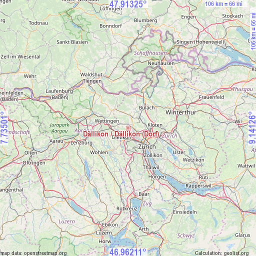
| Upper-left | 47.91325°, | 7.73501° |
| Center: | 47.43983°, | 8.43813° |
| Lower-right: | 46.96211°, | 9.14126° |
| Map W x H: | 105.8×105.8 km | = 65.7×65.7mi |
| max Lat: | 47.76737° ⇑19.2% North |
| Dällikon / Dällikon (Dorf): | 47.43983° |
| min Lat: | ⇓80.8% South 45.83203° |
| min Long | Dällikon / Dä | max Long |
| 5.97153° | 8.43813° | 10.44624° |
| W 52.3%⇐ | ⇒47.7% E |
Elevation
Elevation of Dällikon / Dällikon (Dorf) is 440 m = 1444 ft, and this is 118.2 m = 388 ft below average elevation for this country.
| Max E: |
1845 m = 6053 ft | 69.1% |
| Avg. | 558.2 m = 1831 ft | |
| Dällikon / Dällikon (Dorf) | 440 m = 1444 ft | |
Min E: |
197 m = 646 ft | 30.9% |
See also: Switzerland elevation on elevation.city.
Geographical zone
Dällikon / Dällikon (Dorf) is located in North temperate zone (between Tropic of Cancer and the Arctic Circle). Distance of this North polar circle is 2126.4 km =1321.3 mi to North.| Distance of | km | miles | from Dällikon / Dällikon (Dorf) |
|---|---|---|---|
| North Pole | 4732.2 | 2940.5 | to North |
| Arctic Circle | 2126.4 | 1321.3 | to North |
| Tropic Cancer | 2668.9 | 1658.4 | to South |
| Equator | 5274.8 | 3277.6 | to South |


Nearby cities:
15 places around Dällikon / Dällikon (Dorf): (largest is in red/bold)
• Adlikon
2.3 km =1.4 mi,  69°
69°
• Buchs / Buchs (Nord)
2.3 km =1.4 mi,  355°
355°
• Buchs / Ringstrasse
1.7 km =1.1 mi,  4°
4°
• Buchs / Zürcherstrasse
2 km =1.2 mi,  7°
7°
• Dällikon / Sytenacher
0.5 km =0.3 mi,  107°
107°
• Dänikon / Bifang
2.4 km =1.5 mi,  290°
290°
• Rain
2.2 km =1.4 mi,  281°
281°
• Regensdorf
2.4 km =1.5 mi, 105°
• Regensdorf / Feldblumen-Riedthofstrasse
2.2 km =1.4 mi,  100°
100°
• Regensdorf / Hofacher-Geeren
1.9 km =1.2 mi, 105°
• Regensdorf / Hubacher
2.1 km =1.3 mi,  123°
123°
• Regensdorf / Watterstrasse
2.5 km =1.6 mi, 105°
• Regensdorf / Zentrum
2.5 km =1.6 mi, 113°
• Sonnhalde
2.3 km =1.4 mi,  48°
48°
• Weiningen
2.2 km =1.4 mi,  183°
183°
Sources, notices
• [Note1] Compared only with cities in Switzerland existing in our database
• [Src1] Map data: © OpenStreetMap contributors (CC-BY-SA)
• [Src2] Other city data from geonames.org with taken over terms of usage.
• [Src3] Geographical zone / Annual Mean Temperature by Robert A. Rohde @ Wikipedia
