Adetswil geodata
Adetswil (Zurich) is a populated place; located in Switzerland in Europe/Zurich (GMT+2) time zone. With population of 716 people, there are 1578 cities with bigger population in this country. Compared to other cities in Switzerland, 63.5% of cities are located further ↓South; 82.4% of cities are located further ←West and 84.6% of cities have lower elevation than Adetswil. Note1


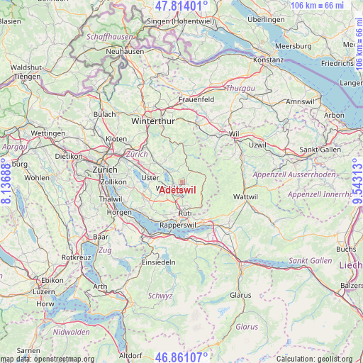
Adetswil GPS coordinates[2]
47° 20' 22.884" North, 8° 50' 24" East
| Map corner | latitude | longitude |
|---|---|---|
| Upper-left | 47.81401°, | 8.13688° |
| Center: | 47.33969°, | 8.84° |
| Lower-right: | 46.86107°, | 9.54313° |
| Map W x H: | 106×106 km | = 65.9×65.9mi |
| max Lat: | 47.76737° ⇑36.5% North |
| Adetswil: | 47.33969° |
| min Lat: | ⇓63.5% South 45.83203° |
| min Long | Adetswil | max Long |
| 5.97153° | 8.84° | 10.44624° |
| W 82.4%⇐ | ⇒17.6% E |
Elevation
Elevation of Adetswil is 731 m = 2398 ft, and this is 172.8 m = 567 ft above average elevation for this country.
| Max E: |
1845 m = 6053 ft | 15.4% |
| Adetswil | 731 m 2398 ft | |
| Avg. | 558.2 m = 1831 ft | |
Min E: |
197 m = 646 ft | 84.6% |
See also: Switzerland elevation on elevation.city.
Geographical zone
Adetswil is located in North temperate zone (between Tropic of Cancer and the Arctic Circle). Distance of this North polar circle is 2137.5 km =1328.2 mi to North.| Distance of | km | miles | from Adetswil |
|---|---|---|---|
| North Pole | 4743.4 | 2947.4 | to North |
| Arctic Circle | 2137.5 | 1328.2 | to North |
| Tropic Cancer | 2657.8 | 1651.5 | to South |
| Equator | 5263.7 | 3270.7 | to South |


Nearby cities:
15 places around Adetswil: (largest is in red/bold)
• Altlandenberg
4.2 km =2.6 mi,  30°
30°
• Bauma
4.3 km =2.7 mi,  43°
43°
• Bäretswil
1.3 km =0.8 mi,  103°
103°
• Hittnau / Hittnau (Dorf)
2.9 km =1.8 mi,  335°
335°
• Oberhittnau
2.4 km =1.5 mi,  329°
329°
• Oberkempten
1.9 km =1.2 mi,  229°
229°
• Pfäffikon
4.5 km =2.8 mi,  307°
307°
• Pfäffikon / Irgenhausen
4.4 km =2.7 mi, 305°
• Weid (bei Adetswil)
0.7 km =0.4 mi,  87°
87°
• Wetzikon
3.5 km =2.2 mi,  245°
245°
• Wetzikon / Kempten
2.4 km =1.5 mi, 252°
• Wetzikon / Ober-Wetzikon
3.4 km =2.1 mi,  241°
241°
• Wetzikon / Robenhausen
4.1 km =2.5 mi,  256°
256°
• Wetzikon / Unter-Wetzikon
4.3 km =2.7 mi, 233°
• Widum
3.8 km =2.4 mi, 250°
Sources, notices
• [Note1] Compared only with cities in Switzerland existing in our database
• [Src1] Map data: © OpenStreetMap contributors (CC-BY-SA)
• [Src2] Other city data from geonames.org with taken over terms of usage.
• [Src3] Geographical zone / Annual Mean Temperature by Robert A. Rohde @ Wikipedia
