Hombrechtikon / Eichberg geodata
Hombrechtikon / Eichberg (Zurich) is a section of populated place; located in Switzerland in Europe/Zurich (GMT+2) time zone. With population of 571 people, there are 1725 cities with bigger population in this country. Compared to other cities in Switzerland, 51.7% of cities are located further ↓South; 79.7% of cities are located further ←West and 52.6% of cities have lower elevation than Hombrechtikon / Eichberg. Note1
Current local time in Hombrechtikon / Eichberg:
07:35 AM, SaturdayDifference from your time zone: hours


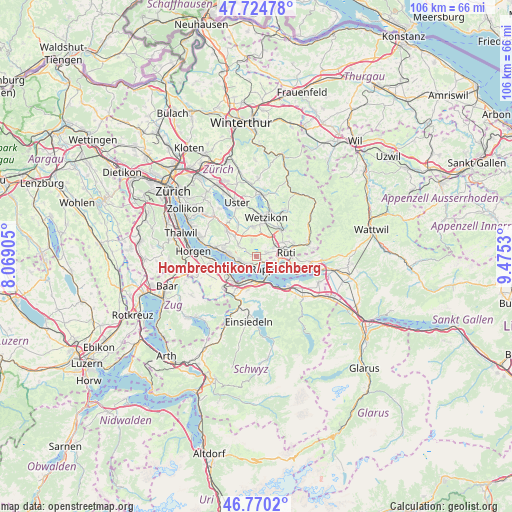
Hombrechtikon / Eichberg GPS coordinates[2]
47° 14' 58.704" North, 8° 46' 19.848" East
| Map corner | latitude | longitude |
|---|---|---|
| Upper-left | 47.72478°, | 8.06905° |
| Center: | 47.24964°, | 8.77218° |
| Lower-right: | 46.7702°, | 9.4753° |
| Map W x H: | 106.1×106.1 km | = 65.9×65.9mi |
| max Lat: | 47.76737° ⇑48.3% North |
| Hombrechtikon / Eichberg: | 47.24964° |
| min Lat: | ⇓51.7% South 45.83203° |
| min Long | Hombrechtikon / | max Long |
| 5.97153° | 8.77218° | 10.44624° |
| W 79.7%⇐ | ⇒20.3% E |
Elevation
Elevation of Hombrechtikon / Eichberg is 486 m = 1594 ft, and this is 72.2 m = 237 ft below average elevation for this country.
| Max E: |
1845 m = 6053 ft | 47.4% |
| Avg. | 558.2 m = 1831 ft | |
| Hombrechtikon / Eichberg | 486 m = 1594 ft | |
Min E: |
197 m = 646 ft | 52.6% |
See also: Switzerland elevation on elevation.city.
Geographical zone
Hombrechtikon / Eichberg is located in North temperate zone (between Tropic of Cancer and the Arctic Circle). Distance of this North polar circle is 2147.5 km =1334.4 mi to North.| Distance of | km | miles | from Hombrechtikon / Eichberg |
|---|---|---|---|
| North Pole | 4753.4 | 2953.6 | to North |
| Arctic Circle | 2147.5 | 1334.4 | to North |
| Tropic Cancer | 2647.7 | 1645.2 | to South |
| Equator | 5253.7 | 3264.5 | to South |


Nearby cities:
15 places around Hombrechtikon / Eichberg: (largest is in red/bold)
• Binzikon
3.1 km =1.9 mi,  340°
340°
• Bubikon
4 km =2.5 mi,  60°
60°
• Bubikon / Station
4.4 km =2.7 mi, 57°
• Dorf
3 km =1.9 mi,  246°
246°
• Hombrechtikon
0.4 km =0.2 mi,  359°
359°
• Hombrechtikon / Bochslen
0.6 km =0.4 mi,  25°
25°
• Hombrechtikon / Grossacher
0.4 km =0.2 mi, 62°
• Hombrechtikon / Tobel
0.8 km =0.5 mi, 57°
• Kehlhof
3 km =1.9 mi,  236°
236°
• Oetwil
4.6 km =2.9 mi,  300°
300°
• Oetwil / Vogelsang
3.9 km =2.4 mi, 298°
• Rapperswil
4.6 km =2.9 mi,  125°
125°
• Stäfa
3.8 km =2.4 mi,  257°
257°
• Uerikon
1.8 km =1.1 mi,  218°
218°
• Wolfhausen
2.2 km =1.4 mi,  70°
70°
Sources, notices
• [Note1] Compared only with cities in Switzerland existing in our database
• [Src1] Map data: © OpenStreetMap contributors (CC-BY-SA)
• [Src2] Other city data from geonames.org with taken over terms of usage.
• [Src3] Geographical zone / Annual Mean Temperature by Robert A. Rohde @ Wikipedia
