Fällanden geodata
Fällanden (Zurich) is a populated place; located in Switzerland in Europe/Zurich (GMT+2) time zone. With population of 2,100 people, there are 806 cities with bigger population in this country. Compared to other cities in Switzerland, 68% of cities are located further ↓South; 69.5% of cities are located further ←West and 63.8% of cities have higher elevation than Fällanden. Note1


Fällanden GPS coordinates[2]
47° 22' 18.084" North, 8° 38' 19.284" East
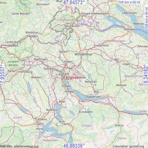
| Map corner | latitude | longitude |
|---|---|---|
| Upper-left | 47.84573°, | 7.93557° |
| Center: | 47.37169°, | 8.63869° |
| Lower-right: | 46.89336°, | 9.34182° |
| Map W x H: | 105.9×105.9 km | = 65.8×65.8mi |
| max Lat: | 47.76737° ⇑32% North |
| Fällanden: | 47.37169° |
| min Lat: | ⇓68% South 45.83203° |
| min Long | Fällanden | max Long |
| 5.97153° | 8.63869° | 10.44624° |
| W 69.5%⇐ | ⇒30.5% E |
Elevation
Elevation of Fällanden is 448 m = 1470 ft, and this is 110.2 m = 362 ft below average elevation for this country.
| Max E: |
1845 m = 6053 ft | 63.8% |
| Avg. | 558.2 m = 1831 ft | |
| Fällanden | 448 m = 1470 ft | |
Min E: |
197 m = 646 ft | 36.2% |
See also: Switzerland elevation on elevation.city.
Geographical zone
Fällanden is located in North temperate zone (between Tropic of Cancer and the Arctic Circle). Distance of this North polar circle is 2133.9 km =1325.9 mi to North.| Distance of | km | miles | from Fällanden |
|---|---|---|---|
| North Pole | 4739.8 | 2945.2 | to North |
| Arctic Circle | 2133.9 | 1325.9 | to North |
| Tropic Cancer | 2661.3 | 1653.7 | to South |
| Equator | 5267.2 | 3272.9 | to South |


Nearby cities:
15 places around Fällanden: (largest is in red/bold)
• Benglen
1.2 km =0.7 mi,  186°
186°
• Binz
1.9 km =1.2 mi,  208°
208°
• Dübendorf / Frickenbuck
2.2 km =1.4 mi,  345°
345°
• Dübendorf / Gfenn
2.4 km =1.5 mi,  14°
14°
• Dübendorf / Sonnenberg
2.6 km =1.6 mi, 348°
• Ebmatingen
2.4 km =1.5 mi,  177°
177°
• Ebmatingen / Bachtobel
2.1 km =1.3 mi, 175°
• Ebmatingen / Lebern
2.6 km =1.6 mi,  173°
173°
• Pfaffhausen
1.4 km =0.9 mi,  235°
235°
• Schwerzenbach
1.8 km =1.1 mi,  50°
50°
• Schwerzenbach / Blatten
1.5 km =0.9 mi,  32°
32°
• Schwerzenbach / Chimli
2.2 km =1.4 mi,  43°
43°
• Schwerzenbach / Chropfacher
1.9 km =1.2 mi, 45°
• Schwerzenbach / Widacher
1.8 km =1.1 mi, 52°
• Zimikon / Rütiwies
2.4 km =1.5 mi,  56°
56°
Sources, notices
• [Note1] Compared only with cities in Switzerland existing in our database
• [Src1] Map data: © OpenStreetMap contributors (CC-BY-SA)
• [Src2] Other city data from geonames.org with taken over terms of usage.
• [Src3] Geographical zone / Annual Mean Temperature by Robert A. Rohde @ Wikipedia
