Oberwinterthur (Kreis 2) / Guggenbühl geodata
Oberwinterthur (Kreis 2) / Guggenbühl (Zurich) is a section of populated place; located in Switzerland in Europe/Zurich (GMT+2) time zone. With population of 5,376 people, there are 314 cities with bigger population in this country. Compared to other cities in Switzerland, 91.2% of cities are located further ↓South; 78.9% of cities are located further ←West and 58.7% of cities have higher elevation than Oberwinterthur (Kreis 2) / Guggenbühl. Note1
Current local time in Oberwinterthur (Kreis 2) / Guggenbühl:
07:42 AM, SaturdayDifference from your time zone: hours


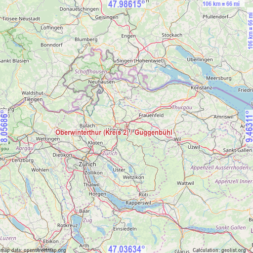
Oberwinterthur (Kreis 2) / Guggenbühl GPS coordinates[2]
47° 30' 48.204" North, 8° 45' 35.928" East
| Map corner | latitude | longitude |
|---|---|---|
| Upper-left | 47.98615°, | 8.05686° |
| Center: | 47.51339°, | 8.75998° |
| Lower-right: | 47.03634°, | 9.46311° |
| Map W x H: | 105.6×105.6 km | = 65.6×65.6mi |
| max Lat: | 47.76737° ⇑8.8% North |
| Oberwinterthur (Kreis 2) / Guggenbühl: | 47.51339° |
| min Lat: | ⇓91.2% South 45.83203° |
| min Long | Oberwinterthur | max Long |
| 5.97153° | 8.75998° | 10.44624° |
| W 78.9%⇐ | ⇒21.1% E |
Elevation
Elevation of Oberwinterthur (Kreis 2) / Guggenbühl is 457 m = 1499 ft, and this is 101.2 m = 332 ft below average elevation for this country.
| Max E: |
1845 m = 6053 ft | 58.7% |
| Avg. | 558.2 m = 1831 ft | |
| Oberwinterthur (Kreis 2) / Guggenbühl | 457 m = 1499 ft | |
Min E: |
197 m = 646 ft | 41.3% |
See also: Switzerland elevation on elevation.city.
Geographical zone
Oberwinterthur (Kreis 2) / Guggenbühl is located in North temperate zone (between Tropic of Cancer and the Arctic Circle). Distance of this North polar circle is 2118.2 km =1316.2 mi to North.| Distance of | km | miles | from Oberwinterthur (Kreis 2) / Guggenbühl |
|---|---|---|---|
| North Pole | 4724.1 | 2935.4 | to North |
| Arctic Circle | 2118.2 | 1316.2 | to North |
| Tropic Cancer | 2677.1 | 1663.5 | to South |
| Equator | 5283 | 3282.7 | to South |


Nearby cities:
15 places around Oberwinterthur (Kreis 2) / Guggenbühl: (largest is in red/bold)
• Mattenbach (Kreis 7) / Deutweg
2.6 km =1.6 mi,  215°
215°
• Mattenbach (Kreis 7) / Gutschick
2.5 km =1.6 mi,  192°
192°
• Oberwinterthur (Kreis 2)
0.8 km =0.5 mi,  58°
58°
• Oberwinterthur (Kreis 2) / Grüze
1.7 km =1.1 mi, 186°
• Oberwinterthur (Kreis 2) / Hegi
1.1 km =0.7 mi,  131°
131°
• Oberwinterthur (Kreis 2) / Hegmatten
0.5 km =0.3 mi,  152°
152°
• Oberwinterthur (Kreis 2) / Talacker
1 km =0.6 mi, 217°
• Oberwinterthur (Kreis 2) / Zinzikon
0.7 km =0.4 mi,  338°
338°
• Rümikon
2.4 km =1.5 mi,  121°
121°
• Seen (Kreis 3) / Sonnenberg
2.8 km =1.7 mi,  163°
163°
• Seen (Kreis 3) / Waser
2.7 km =1.7 mi,  179°
179°
• Stadt Winterthur (Kreis 1) / Altstadt
2.8 km =1.7 mi,  236°
236°
• Stadt Winterthur (Kreis 1) / Lind
2.1 km =1.3 mi,  246°
246°
• Wiesendangen / Steinegg
2.3 km =1.4 mi,  45°
45°
• Wiesendangen / Wiesendangen (Dorf)
2.4 km =1.5 mi,  67°
67°
Sources, notices
• [Note1] Compared only with cities in Switzerland existing in our database
• [Src1] Map data: © OpenStreetMap contributors (CC-BY-SA)
• [Src2] Other city data from geonames.org with taken over terms of usage.
• [Src3] Geographical zone / Annual Mean Temperature by Robert A. Rohde @ Wikipedia
