Ober-Ohringen geodata
Ober-Ohringen (Zurich) is a populated place; located in Switzerland in Europe/Zurich (GMT+2) time zone. With population of 700 people, there are 1598 cities with bigger population in this country. Compared to other cities in Switzerland, 92.9% of cities are located further ↓South; 75.3% of cities are located further ←West and 59% of cities have higher elevation than Ober-Ohringen. Note1


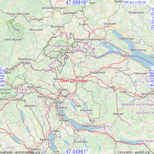
Ober-Ohringen GPS coordinates[2]
47° 31' 35.544" North, 8° 42' 49.824" East
| Map corner | latitude | longitude |
|---|---|---|
| Upper-left | 47.99918°, | 8.01072° |
| Center: | 47.52654°, | 8.71384° |
| Lower-right: | 47.04961°, | 9.41697° |
| Map W x H: | 105.6×105.6 km | = 65.6×65.6mi |
| max Lat: | 47.76737° ⇑7.1% North |
| Ober-Ohringen: | 47.52654° |
| min Lat: | ⇓92.9% South 45.83203° |
| min Long | Ober-Ohringen | max Long |
| 5.97153° | 8.71384° | 10.44624° |
| W 75.3%⇐ | ⇒24.7% E |
Elevation
Elevation of Ober-Ohringen is 456 m = 1496 ft, and this is 102.2 m = 335 ft below average elevation for this country.
| Max E: |
1845 m = 6053 ft | 59% |
| Avg. | 558.2 m = 1831 ft | |
| Ober-Ohringen | 456 m = 1496 ft | |
Min E: |
197 m = 646 ft | 41% |
See also: Switzerland elevation on elevation.city.
Geographical zone
Ober-Ohringen is located in North temperate zone (between Tropic of Cancer and the Arctic Circle). Distance of this North polar circle is 2116.7 km =1315.3 mi to North.| Distance of | km | miles | from Ober-Ohringen |
|---|---|---|---|
| North Pole | 4722.6 | 2934.5 | to North |
| Arctic Circle | 2116.7 | 1315.3 | to North |
| Tropic Cancer | 2678.5 | 1664.3 | to South |
| Equator | 5284.5 | 3283.6 | to South |


Nearby cities:
15 places around Ober-Ohringen: (largest is in red/bold)
• Hettlingen
2.3 km =1.4 mi,  343°
343°
• Hettlingen / Dorfkern
2.3 km =1.4 mi,  347°
347°
• Hettlingen / Gübel
2.4 km =1.5 mi,  3°
3°
• Seuzach / Seuzach (Dorf)
2 km =1.2 mi,  60°
60°
• Seuzach Dorf
1.7 km =1.1 mi,  53°
53°
• Seuzach Dorf / Brandbüel
2.4 km =1.5 mi, 61°
• Seuzach Dorf / Breite-Weid
1.7 km =1.1 mi, 63°
• Seuzach Dorf / Hochgrüt-Scheidweg
1.3 km =0.8 mi,  71°
71°
• Seuzach Dorf / Pünten-Ifang
1.7 km =1.1 mi,  43°
43°
• Veltheim (Kreis 5)
1.4 km =0.9 mi,  170°
170°
• Veltheim (Kreis 5) / Blumenau
2.3 km =1.4 mi,  176°
176°
• Veltheim (Kreis 5) / Rosenberg
1.4 km =0.9 mi, 173°
• Winterthur
2.4 km =1.5 mi,  161°
161°
• Wülflingen (Kreis 6) / Lindenplatz
2.3 km =1.4 mi,  222°
222°
• Wülflingen (Kreis 6) / Weinberg
2 km =1.2 mi,  209°
209°
Sources, notices
• [Note1] Compared only with cities in Switzerland existing in our database
• [Src1] Map data: © OpenStreetMap contributors (CC-BY-SA)
• [Src2] Other city data from geonames.org with taken over terms of usage.
• [Src3] Geographical zone / Annual Mean Temperature by Robert A. Rohde @ Wikipedia
