Zürich (Kreis 2) / Wollishofen geodata
Zürich (Kreis 2) / Wollishofen (Zurich) is a section of populated place; located in Switzerland in Europe/Zurich (GMT+2) time zone. With population of 16,073 people, there are 69 cities with bigger population in this country. Compared to other cities in Switzerland, 63.6% of cities are located further ↓South; 59.8% of cities are located further ←West and 64.5% of cities have higher elevation than Zürich (Kreis 2) / Wollishofen. Note1
Current local time in Zürich (Kreis 2) / Wollishofen:
10:22 AM, SaturdayDifference from your time zone: hours


Zürich (Kreis 2) / Wollishofen GPS coordinates[2]
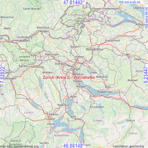
47° 20' 24.36" North, 8° 31' 52.824" East
| Map corner | latitude | longitude |
|---|---|---|
| Upper-left | 47.81442°, | 7.82822° |
| Center: | 47.3401°, | 8.53134° |
| Lower-right: | 46.86148°, | 9.23447° |
| Map W x H: | 106×106 km | = 65.9×65.9mi |
| max Lat: | 47.76737° ⇑36.4% North |
| Zürich (Kreis 2) / Wollishofen: | 47.3401° |
| min Lat: | ⇓63.6% South 45.83203° |
| min Long | Zürich (Kreis | max Long |
| 5.97153° | 8.53134° | 10.44624° |
| W 59.8%⇐ | ⇒40.2% E |
Elevation
Elevation of Zürich (Kreis 2) / Wollishofen is 447 m = 1467 ft, and this is 111.2 m = 365 ft below average elevation for this country.
| Max E: |
1845 m = 6053 ft | 64.5% |
| Avg. | 558.2 m = 1831 ft | |
| Zürich (Kreis 2) / Wollishofen | 447 m = 1467 ft | |
Min E: |
197 m = 646 ft | 35.5% |
See also: Switzerland elevation on elevation.city.
Geographical zone
Zürich (Kreis 2) / Wollishofen is located in North temperate zone (between Tropic of Cancer and the Arctic Circle). Distance of this North polar circle is 2137.4 km =1328.1 mi to North.| Distance of | km | miles | from Zürich (Kreis 2) / Wollishofen |
|---|---|---|---|
| North Pole | 4743.3 | 2947.3 | to North |
| Arctic Circle | 2137.4 | 1328.1 | to North |
| Tropic Cancer | 2657.8 | 1651.5 | to South |
| Equator | 5263.7 | 3270.7 | to South |


Nearby cities:
15 places around Zürich (Kreis 2) / Wollishofen: (largest is in red/bold)
• Adliswil / Lebern
2.7 km =1.7 mi,  176°
176°
• Adliswil / Oberleimbach
2.5 km =1.6 mi,  208°
208°
• Adliswil / Sihlhof
2.1 km =1.3 mi,  200°
200°
• Adliswil / Sood
2.4 km =1.5 mi,  192°
192°
• Kilchberg
2 km =1.2 mi,  148°
148°
• Kilchberg / Bendlikon
2.3 km =1.4 mi,  144°
144°
• Kilchberg / Bächler-Stocken
1.6 km =1 mi,  156°
156°
• Kilchberg / Hornhalden
1.3 km =0.8 mi, 140°
• Kilchberg / Kilchberg (Dorfkern)
2.4 km =1.5 mi, 158°
• Zürich (Kreis 2)
0.8 km =0.5 mi,  249°
249°
• Zürich (Kreis 2) / Enge
2.3 km =1.4 mi,  359°
359°
• Zürich (Kreis 2) / Mittel-Leimbach
2.1 km =1.3 mi,  218°
218°
• Zürich (Kreis 2) / Unter-Leimbach
1.5 km =0.9 mi,  240°
240°
• Zürich (Kreis 8) / Mühlebach
2.7 km =1.7 mi,  45°
45°
• Zürich (Kreis 8) / Seefeld
2.4 km =1.5 mi, 48°
Sources, notices
• [Note1] Compared only with cities in Switzerland existing in our database
• [Src1] Map data: © OpenStreetMap contributors (CC-BY-SA)
• [Src2] Other city data from geonames.org with taken over terms of usage.
• [Src3] Geographical zone / Annual Mean Temperature by Robert A. Rohde @ Wikipedia
