Zürich (Kreis 4) / Hard geodata
Zürich (Kreis 4) / Hard (Zurich) is a section of populated place; located in Switzerland in Europe/Zurich (GMT+2) time zone. With population of 12,976 people, there are 100 cities with bigger population in this country. Compared to other cities in Switzerland, 69.6% of cities are located further ↓South; 57.3% of cities are located further ←West and 85.1% of cities have higher elevation than Zürich (Kreis 4) / Hard. Note1
Current local time in Zürich (Kreis 4) / Hard:
10:24 AM, SaturdayDifference from your time zone: hours


Zürich (Kreis 4) / Hard GPS coordinates[2]
47° 22' 59.196" North, 8° 30' 33.912" East
| Map corner | latitude | longitude |
|---|---|---|
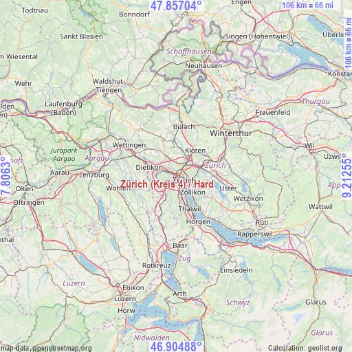
| Upper-left | 47.85704°, | 7.8063° |
| Center: | 47.38311°, | 8.50942° |
| Lower-right: | 46.90488°, | 9.21255° |
| Map W x H: | 105.9×105.9 km | = 65.8×65.8mi |
| max Lat: | 47.76737° ⇑30.4% North |
| Zürich (Kreis 4) / Hard: | 47.38311° |
| min Lat: | ⇓69.6% South 45.83203° |
| min Long | Zürich (Kreis | max Long |
| 5.97153° | 8.50942° | 10.44624° |
| W 57.3%⇐ | ⇒42.7% E |
Elevation
Elevation of Zürich (Kreis 4) / Hard is 410 m = 1345 ft, and this is 148.2 m = 486 ft below average elevation for this country.
| Max E: |
1845 m = 6053 ft | 85.1% |
| Avg. | 558.2 m = 1831 ft | |
| Zürich (Kreis 4) / Hard | 410 m = 1345 ft | |
Min E: |
197 m = 646 ft | 14.9% |
See also: Switzerland elevation on elevation.city.
Geographical zone
Zürich (Kreis 4) / Hard is located in North temperate zone (between Tropic of Cancer and the Arctic Circle). Distance of this North polar circle is 2132.7 km =1325.2 mi to North.| Distance of | km | miles | from Zürich (Kreis 4) / Hard |
|---|---|---|---|
| North Pole | 4738.6 | 2944.4 | to North |
| Arctic Circle | 2132.7 | 1325.2 | to North |
| Tropic Cancer | 2662.6 | 1654.5 | to South |
| Equator | 5268.5 | 3273.7 | to South |


Nearby cities:
15 places around Zürich (Kreis 4) / Hard: (largest is in red/bold)
• Zürich (Kreis 1) / City
2.3 km =1.4 mi,  120°
120°
• Zürich (Kreis 10) / Höngg
2.4 km =1.5 mi,  337°
337°
• Zürich (Kreis 10) / Wipkingen
1.8 km =1.1 mi,  42°
42°
• Zürich (Kreis 3) / Alt-Wiedikon
2.4 km =1.5 mi,  169°
169°
• Zürich (Kreis 3) / Friesenberg
2.2 km =1.4 mi,  190°
190°
• Zürich (Kreis 3) / Sihlfeld
1 km =0.6 mi, 170°
• Zürich (Kreis 4) / Aussersihl
1.1 km =0.7 mi, 124°
• Zürich (Kreis 4) / Langstrasse
1.6 km =1 mi,  112°
112°
• Zürich (Kreis 4) / Werd
1.8 km =1.1 mi,  135°
135°
• Zürich (Kreis 5)
1 km =0.6 mi,  60°
60°
• Zürich (Kreis 5) / Escher-Wyss
0.9 km =0.6 mi,  17°
17°
• Zürich (Kreis 5) / Gewerbeschule
1.6 km =1 mi,  83°
83°
• Zürich (Kreis 9)
2.2 km =1.4 mi,  268°
268°
• Zürich (Kreis 9) / Albisrieden
1.8 km =1.1 mi,  235°
235°
• Zürich (Kreis 9) / Altstetten
1.9 km =1.2 mi,  291°
291°
Sources, notices
• [Note1] Compared only with cities in Switzerland existing in our database
• [Src1] Map data: © OpenStreetMap contributors (CC-BY-SA)
• [Src2] Other city data from geonames.org with taken over terms of usage.
• [Src3] Geographical zone / Annual Mean Temperature by Robert A. Rohde @ Wikipedia
