Zürich (Kreis 9) / Albisrieden geodata
Zürich (Kreis 9) / Albisrieden (Zurich) is a section of populated place; located in Switzerland in Europe/Zurich (GMT+2) time zone. With population of 16,480 people, there are 61 cities with bigger population in this country. Compared to other cities in Switzerland, 68.6% of cities are located further ↓South; 56.3% of cities are located further ←West and 76.6% of cities have higher elevation than Zürich (Kreis 9) / Albisrieden. Note1
Current local time in Zürich (Kreis 9) / Albisrieden:
08:52 AM, SaturdayDifference from your time zone: hours


Zürich (Kreis 9) / Albisrieden GPS coordinates[2]
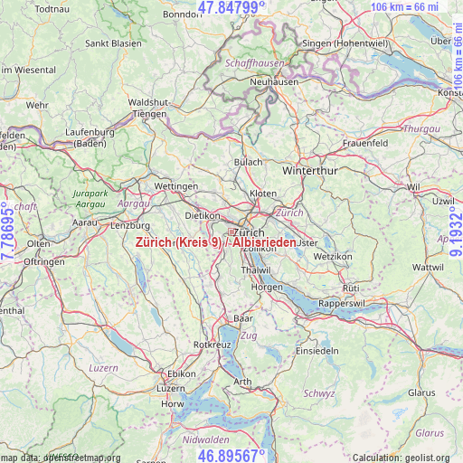
47° 22' 26.328" North, 8° 29' 24.252" East
| Map corner | latitude | longitude |
|---|---|---|
| Upper-left | 47.84799°, | 7.78695° |
| Center: | 47.37398°, | 8.49007° |
| Lower-right: | 46.89567°, | 9.1932° |
| Map W x H: | 105.9×105.9 km | = 65.8×65.8mi |
| max Lat: | 47.76737° ⇑31.4% North |
| Zürich (Kreis 9) / Albisrieden: | 47.37398° |
| min Lat: | ⇓68.6% South 45.83203° |
| min Long | Zürich (Kreis | max Long |
| 5.97153° | 8.49007° | 10.44624° |
| W 56.3%⇐ | ⇒43.7% E |
Elevation
Elevation of Zürich (Kreis 9) / Albisrieden is 428 m = 1404 ft, and this is 130.2 m = 427 ft below average elevation for this country.
| Max E: |
1845 m = 6053 ft | 76.6% |
| Avg. | 558.2 m = 1831 ft | |
| Zürich (Kreis 9) / Albisrieden | 428 m = 1404 ft | |
Min E: |
197 m = 646 ft | 23.4% |
See also: Switzerland elevation on elevation.city.
Geographical zone
Zürich (Kreis 9) / Albisrieden is located in North temperate zone (between Tropic of Cancer and the Arctic Circle). Distance of this North polar circle is 2133.7 km =1325.8 mi to North.| Distance of | km | miles | from Zürich (Kreis 9) / Albisrieden |
|---|---|---|---|
| North Pole | 4739.6 | 2945 | to North |
| Arctic Circle | 2133.7 | 1325.8 | to North |
| Tropic Cancer | 2661.6 | 1653.8 | to South |
| Equator | 5267.5 | 3273.1 | to South |


Nearby cities:
15 places around Zürich (Kreis 9) / Albisrieden: (largest is in red/bold)
• Birmensdorf / Haslen
2.7 km =1.7 mi,  235°
235°
• Uitikon
2.5 km =1.6 mi,  257°
257°
• Uitikon / Halde
2.6 km =1.6 mi,  266°
266°
• Uitikon / Waldegg
2.3 km =1.4 mi, 238°
• Zürich (Kreis 3)
2 km =1.2 mi,  151°
151°
• Zürich (Kreis 3) / Alt-Wiedikon
2.3 km =1.4 mi,  125°
125°
• Zürich (Kreis 3) / Friesenberg
1.6 km =1 mi,  137°
137°
• Zürich (Kreis 3) / Sihlfeld
1.6 km =1 mi,  90°
90°
• Zürich (Kreis 4) / Aussersihl
2.4 km =1.5 mi,  80°
80°
• Zürich (Kreis 4) / Hard
1.8 km =1.1 mi,  55°
55°
• Zürich (Kreis 4) / Werd
2.7 km =1.7 mi,  95°
95°
• Zürich (Kreis 5)
2.8 km =1.7 mi, 57°
• Zürich (Kreis 5) / Escher-Wyss
2.5 km =1.6 mi,  43°
43°
• Zürich (Kreis 9)
1.2 km =0.7 mi,  320°
320°
• Zürich (Kreis 9) / Altstetten
1.8 km =1.1 mi,  348°
348°
Sources, notices
• [Note1] Compared only with cities in Switzerland existing in our database
• [Src1] Map data: © OpenStreetMap contributors (CC-BY-SA)
• [Src2] Other city data from geonames.org with taken over terms of usage.
• [Src3] Geographical zone / Annual Mean Temperature by Robert A. Rohde @ Wikipedia
