Zürich (Kreis 5) / Escher-Wyss geodata
Zürich (Kreis 5) / Escher-Wyss (Zurich) is a section of populated place; located in Switzerland in Europe/Zurich (GMT+2) time zone. With population of 1,846 people, there are 890 cities with bigger population in this country. Compared to other cities in Switzerland, 71.2% of cities are located further ↓South; 57.6% of cities are located further ←West and 87.8% of cities have higher elevation than Zürich (Kreis 5) / Escher-Wyss. Note1
Current local time in Zürich (Kreis 5) / Escher-Wyss:
10:22 AM, SaturdayDifference from your time zone: hours


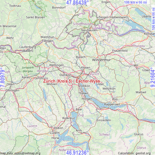
Zürich (Kreis 5) / Escher-Wyss GPS coordinates[2]
47° 23' 25.872" North, 8° 30' 46.512" East
| Map corner | latitude | longitude |
|---|---|---|
| Upper-left | 47.86439°, | 7.80979° |
| Center: | 47.39052°, | 8.51292° |
| Lower-right: | 46.91236°, | 9.21604° |
| Map W x H: | 105.9×105.9 km | = 65.8×65.8mi |
| max Lat: | 47.76737° ⇑28.8% North |
| Zürich (Kreis 5) / Escher-Wyss: | 47.39052° |
| min Lat: | ⇓71.2% South 45.83203° |
| min Long | Zürich (Kreis | max Long |
| 5.97153° | 8.51292° | 10.44624° |
| W 57.6%⇐ | ⇒42.4% E |
Elevation
Elevation of Zürich (Kreis 5) / Escher-Wyss is 403 m = 1322 ft, and this is 155.2 m = 509 ft below average elevation for this country.
| Max E: |
1845 m = 6053 ft | 87.8% |
| Avg. | 558.2 m = 1831 ft | |
| Zürich (Kreis 5) / Escher-Wyss | 403 m = 1322 ft | |
Min E: |
197 m = 646 ft | 12.2% |
See also: Switzerland elevation on elevation.city.
Geographical zone
Zürich (Kreis 5) / Escher-Wyss is located in North temperate zone (between Tropic of Cancer and the Arctic Circle). Distance of this North polar circle is 2131.8 km =1324.6 mi to North.| Distance of | km | miles | from Zürich (Kreis 5) / Escher-Wyss |
|---|---|---|---|
| North Pole | 4737.7 | 2943.9 | to North |
| Arctic Circle | 2131.8 | 1324.6 | to North |
| Tropic Cancer | 2663.4 | 1655 | to South |
| Equator | 5269.3 | 3274.2 | to South |


Nearby cities:
15 places around Zürich (Kreis 5) / Escher-Wyss: (largest is in red/bold)
• Zürich (Kreis 1) / City
2.6 km =1.6 mi,  139°
139°
• Zürich (Kreis 10)
2.1 km =1.3 mi,  333°
333°
• Zürich (Kreis 10) / Höngg
1.8 km =1.1 mi,  319°
319°
• Zürich (Kreis 10) / Wipkingen
1.1 km =0.7 mi,  61°
61°
• Zürich (Kreis 3) / Sihlfeld
1.9 km =1.2 mi,  182°
182°
• Zürich (Kreis 4) / Aussersihl
1.6 km =1 mi,  156°
156°
• Zürich (Kreis 4) / Hard
0.9 km =0.6 mi,  197°
197°
• Zürich (Kreis 4) / Langstrasse
1.9 km =1.2 mi, 140°
• Zürich (Kreis 4) / Werd
2.3 km =1.4 mi,  154°
154°
• Zürich (Kreis 5)
0.7 km =0.4 mi,  116°
116°
• Zürich (Kreis 5) / Gewerbeschule
1.4 km =0.9 mi, 116°
• Zürich (Kreis 6)
2.3 km =1.4 mi,  85°
85°
• Zürich (Kreis 6) / Unterstrass
1.9 km =1.2 mi,  73°
73°
• Zürich (Kreis 9) / Albisrieden
2.5 km =1.6 mi,  223°
223°
• Zürich (Kreis 9) / Altstetten
2.1 km =1.3 mi,  266°
266°
Sources, notices
• [Note1] Compared only with cities in Switzerland existing in our database
• [Src1] Map data: © OpenStreetMap contributors (CC-BY-SA)
• [Src2] Other city data from geonames.org with taken over terms of usage.
• [Src3] Geographical zone / Annual Mean Temperature by Robert A. Rohde @ Wikipedia
