Tocopilla geodata
Tocopilla (Antofagasta) is a seat of a second-order administrative division; located in Chile in America/Santiago (GMT-4) time zone. With population of 24,460 people, there are 70 cities with bigger population in this country. Compared to other cities in Chile, 96.6% of cities are located further ↓South; 93.8% of cities are located further ←West and 73.8% of cities have higher elevation than Tocopilla. Note1


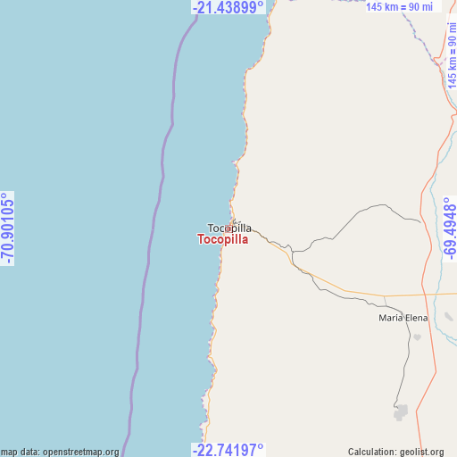
Tocopilla GPS coordinates[2]
22° 5' 31.128" South, 70° 11' 52.512" West
| Map corner | latitude | longitude |
|---|---|---|
| Upper-left | -21.43899°, | -70.90105° |
| Center: | -22.09198°, | -70.19792° |
| Lower-right: | -22.74197°, | -69.4948° |
| Map W x H: | 144.9×144.9 km | = 90×90mi |
| max Lat: | -18.19821° ⇑3.4% North |
| Tocopilla: | -22.09198° |
| min Lat: | ⇓96.6% South -54.93355° |
| min Long | Tocopilla | max Long |
| -109.42438° | -70.19792° | -67.60963° |
| W 93.8%⇐ | ⇒6.2% E |
Elevation
Elevation of Tocopilla is 37 m = 121 ft, and this is 236 m = 774 ft below average elevation for this country.
| Max E: |
3544 m = 11627 ft | 73.8% |
| Avg. | 273 m = 896 ft | |
| Tocopilla | 37 m = 121 ft | |
Min E: |
1 m = 3 ft | 26.2% |
See also: Chile elevation on elevation.city.
Geographical zone
Tocopilla is located in South Torrid zone (between Equator and Tropic of Capricorn). Distance of this Southern Tropic circle is 149.5 km =92.9 mi to South.| Distance of | km | miles | from Tocopilla |
|---|---|---|---|
| Equator | 2456.4 | 1526.3 | to North |
| Tropic Capricorn | 149.5 | 92.9 | to South |
| Antarctic Circle | 4944.8 | 3072.6 | to South |
| South Pole | 7550.7 | 4691.8 | to South |


Nearby cities:
9 places around Tocopilla: (largest is in red/bold)
• Antofagasta
174.7 km =108.6 mi,  186°
186°
• Arica
402.4 km =250 mi,  358°
358°
• Calama
137.2 km =85.3 mi,  107°
107°
• Iquique
209 km =129.9 mi,  1°
1°
• Pica
199.3 km =123.8 mi,  26°
26°
• Pozo Almonte
208.6 km =129.6 mi,  11°
11°
• Putre
438 km =272.2 mi, 8°
• San Pedro de Atacama
224.4 km =139.4 mi, 113°
• Taltal
369.8 km =229.8 mi,  184°
184°
Sources, notices
• [Note1] Compared only with cities in Chile existing in our database
• [Src1] Map data: © OpenStreetMap contributors (CC-BY-SA)
• [Src2] Other city data from geonames.org with taken over terms of usage.
• [Src3] Geographical zone / Annual Mean Temperature by Robert A. Rohde @ Wikipedia
