San Pedro de Atacama geodata
San Pedro de Atacama (Antofagasta) is a populated place; located in Chile in America/Santiago (GMT-4) time zone. With population of 2,000 people, there are 126 cities with bigger population in this country. Compared to other cities in Chile, 95.2% of cities are located further ↓South; 99.3% of cities are located further ←West and 99.3% of cities have lower elevation than San Pedro de Atacama. Note1
Administrative division(s):
- Level 1: Antofagasta
- Level 2: Provincia de El Loa
- Level 3: San Pedro de Atacama


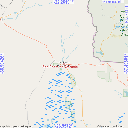
San Pedro de Atacama GPS coordinates[2]
22° 54' 39.96" South, 68° 12' 4.068" West
| Map corner | latitude | longitude |
|---|---|---|
| Upper-left | -22.26191°, | -68.90426° |
| Center: | -22.9111°, | -68.20113° |
| Lower-right: | -23.5572°, | -67.49801° |
| Map W x H: | 144×144 km | = 89.5×89.5mi |
| max Lat: | -18.19821° ⇑4.8% North |
| San Pedro de Atacama: | -22.9111° |
| min Lat: | ⇓95.2% South -54.93355° |
| min Long | San Pedro de At | max Long |
| -109.42438° | -68.20113° | -67.60963° |
| W 99.3%⇐ | ⇒0.7% E |
Elevation
Elevation of San Pedro de Atacama is 2444 m = 8018 ft, and this is 2171 m = 7123 ft above average elevation for this country.
| Max E: |
3544 m = 11627 ft | 0.7% |
| San Pedro de Atacama | 2444 m 8018 ft | |
| Avg. | 273 m = 896 ft | |
Min E: |
1 m = 3 ft | 99.3% |
See also: Chile elevation on elevation.city.
Geographical zone
San Pedro de Atacama is located in South Torrid zone (between Equator and Tropic of Capricorn). Distance of this Southern Tropic circle is 58.4 km =36.3 mi to South.| Distance of | km | miles | from San Pedro de Atacama |
|---|---|---|---|
| Equator | 2547.5 | 1582.9 | to North |
| Tropic Capricorn | 58.4 | 36.3 | to South |
| Antarctic Circle | 4853.7 | 3015.9 | to South |
| South Pole | 7459.6 | 4635.2 | to South |


Nearby cities:
8 places around San Pedro de Atacama: (largest is in red/bold)
• Antofagasta
238.8 km =148.4 mi,  249°
249°
• Calama
89.7 km =55.7 mi,  304°
304°
• Diego de Almagro
427.2 km =265.4 mi,  205°
205°
• Iquique
361.4 km =224.6 mi,  326°
326°
• Pica
293.3 km =182.2 mi,  336°
336°
• Pozo Almonte
337.7 km =209.8 mi, 330°
• Taltal
361.6 km =224.7 mi,  219°
219°
• Tocopilla
224.4 km =139.4 mi,  293°
293°
Sources, notices
• [Note1] Compared only with cities in Chile existing in our database
• [Src1] Map data: © OpenStreetMap contributors (CC-BY-SA)
• [Src2] Other city data from geonames.org with taken over terms of usage.
• [Src3] Geographical zone / Annual Mean Temperature by Robert A. Rohde @ Wikipedia
