Antofagasta geodata
Antofagasta is a seat of a first-order administrative division; located in Chile in America/Santiago (GMT-4) time zone. With population of 309,832 people, there are 2 cities with bigger population in this country. Compared to other cities in Chile, 94.5% of cities are located further ↓South; 90.3% of cities are located further ←West and 76.6% of cities have higher elevation than Antofagasta. Note1
Administrative division(s):
- Level 1: Antofagasta
- Level 2: Provincia de Antofagasta
- Level 3: Antofagasta


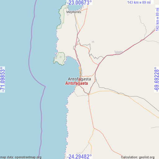
Antofagasta GPS coordinates[2]
23° 39' 8.496" South, 70° 23' 43.44" West
| Map corner | latitude | longitude |
|---|---|---|
| Upper-left | -23.00673°, | -71.09853° |
| Center: | -23.65236°, | -70.3954° |
| Lower-right: | -24.29482°, | -69.69228° |
| Map W x H: | 143.2×143.2 km | = 89×89mi |
| max Lat: | -18.19821° ⇑5.5% North |
| Antofagasta: | -23.65236° |
| min Lat: | ⇓94.5% South -54.93355° |
| min Long | Antofagasta | max Long |
| -109.42438° | -70.3954° | -67.60963° |
| W 90.3%⇐ | ⇒9.7% E |
Elevation
Elevation of Antofagasta is 31 m = 102 ft, and this is 242 m = 794 ft below average elevation for this country.
| Max E: |
3544 m = 11627 ft | 76.6% |
| Avg. | 273 m = 896 ft | |
| Antofagasta | 31 m = 102 ft | |
Min E: |
1 m = 3 ft | 23.4% |
See also: Antofagasta elevation on elevation.city.
Geographical zone
Antofagasta is located in South temperate zone (between Tropic of Capricorn and the Antarctic Circle). Distance of this Southern Tropic circle is 24 km =14.9 mi to North.| Distance of | km | miles | from Antofagasta |
|---|---|---|---|
| Equator | 2629.9 | 1634.1 | to North |
| Tropic Capricorn | 24 | 14.9 | to North |
| Antarctic Circle | 4771.3 | 2964.7 | to South |
| South Pole | 7377.2 | 4584 | to South |


Nearby cities:
10 places around Antofagasta: (largest is in red/bold)
• Calama
200.9 km =124.8 mi,  48°
48°
• Chañaral
300 km =186.4 mi,  184°
184°
• Copiapó
413.1 km =256.7 mi, 179°
• Diego de Almagro
303.8 km =188.8 mi,  173°
173°
• Iquique
383.2 km =238.1 mi,  3°
3°
• Pica
368.2 km =228.8 mi,  17°
17°
• Pozo Almonte
382.8 km =237.9 mi,  9°
9°
• San Pedro de Atacama
238.8 km =148.4 mi,  69°
69°
• Taltal
195.3 km =121.4 mi, 182°
• Tocopilla
174.7 km =108.6 mi, 6°
Sources, notices
• [Note1] Compared only with cities in Chile existing in our database
• [Src1] Map data: © OpenStreetMap contributors (CC-BY-SA)
• [Src2] Other city data from geonames.org with taken over terms of usage.
• [Src3] Geographical zone / Annual Mean Temperature by Robert A. Rohde @ Wikipedia
