Pica geodata
Pica (Tarapacá) is a seat of a third-order administrative division; located in Chile in America/Santiago (GMT-4) time zone. In our database, there are 135 cities with bigger population. Compared to other cities in Chile, 97.2% of cities are located further ↓South; 97.9% of cities are located further ←West and 97.2% of cities have lower elevation than Pica. Note1


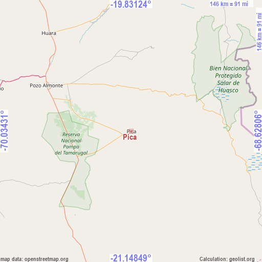
Pica GPS coordinates[2]
20° 29' 28.608" South, 69° 19' 52.248" West
| Map corner | latitude | longitude |
|---|---|---|
| Upper-left | -19.83124°, | -70.03431° |
| Center: | -20.49128°, | -69.33118° |
| Lower-right: | -21.14849°, | -68.62806° |
| Map W x H: | 146.5×146.5 km | = 91×91mi |
| max Lat: | -18.19821° ⇑2.8% North |
| Pica: | -20.49128° |
| min Lat: | ⇓97.2% South -54.93355° |
| min Long | Pica | max Long |
| -109.42438° | -69.33118° | -67.60963° |
| W 97.9%⇐ | ⇒2.1% E |
Elevation
Elevation of Pica is 1327 m = 4354 ft, and this is 1054 m = 3458 ft above average elevation for this country.
| Max E: |
3544 m = 11627 ft | 2.8% |
| Pica | 1327 m 4354 ft | |
| Avg. | 273 m = 896 ft | |
Min E: |
1 m = 3 ft | 97.2% |
See also: Chile elevation on elevation.city.
Geographical zone
Pica is located in South Torrid zone (between Equator and Tropic of Capricorn). Distance of this Southern Tropic circle is 327.5 km =203.5 mi to South.| Distance of | km | miles | from Pica |
|---|---|---|---|
| Equator | 2278.4 | 1415.7 | to North |
| Tropic Capricorn | 327.5 | 203.5 | to South |
| Antarctic Circle | 5122.8 | 3183.2 | to South |
| South Pole | 7728.6 | 4802.3 | to South |


Nearby cities:
8 places around Pica: (largest is in red/bold)
• Antofagasta
368.2 km =228.8 mi,  197°
197°
• Arica
246.1 km =152.9 mi,  335°
335°
• Calama
222.6 km =138.3 mi,  169°
169°
• Iquique
90.8 km =56.4 mi,  289°
289°
• Pozo Almonte
54.2 km =33.7 mi,  298°
298°
• Putre
256.1 km =159.1 mi,  354°
354°
• San Pedro de Atacama
293.3 km =182.2 mi,  156°
156°
• Tocopilla
199.3 km =123.8 mi,  206°
206°
Sources, notices
• [Note1] Compared only with cities in Chile existing in our database
• [Src1] Map data: © OpenStreetMap contributors (CC-BY-SA)
• [Src2] Other city data from geonames.org with taken over terms of usage.
• [Src3] Geographical zone / Annual Mean Temperature by Robert A. Rohde @ Wikipedia
