Zitong geodata
Zitong (Chongqing) is a seat of a third-order administrative division; located in China in Asia/Shanghai (GMT+8) time zone. In our database, there are 1268 cities with bigger population. Compared to other cities in China, 52.3% of cities are located further ↑North; 87.4% of cities are located further →East and 59.9% of cities have lower elevation than Zitong. Note1


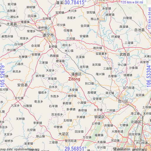
Zitong GPS coordinates[2]
30° 10' 41.52" North, 105° 49' 47.676" East
| Map corner | latitude | longitude |
|---|---|---|
| Upper-left | 30.78415°, | 105.12679° |
| Center: | 30.1782°, | 105.82991° |
| Lower-right: | 29.56851°, | 106.53304° |
| Map W x H: | 135.2×135.2 km | = 84×84mi |
| max Lat: | 53.31946° ⇑52.3% North |
| Zitong: | 30.1782° |
| min Lat: | ⇓47.7% South 18.22056° |
| min Long | Zitong | max Long |
| 75.07348° | 105.82991° | 134.28917° |
| W 12.6%⇐ | ⇒87.4% E |
Elevation
Elevation of Zitong is 258 m = 846 ft, and this is 226.8 m = 744 ft below average elevation for this country.
| Max E: |
5622 m = 18445 ft | 40.1% |
| Avg. | 484.8 m = 1591 ft | |
| Zitong | 258 m = 846 ft | |
Min E: |
-3 m = -10 ft | 59.9% |
See also: China elevation on elevation.city.
Geographical zone
Zitong is located in North temperate zone (between Tropic of Cancer and the Arctic Circle). Distance of this Northern Tropic circle is 749.6 km =465.8 mi to South.| Distance of | km | miles | from Zitong |
|---|---|---|---|
| North Pole | 6651.6 | 4133.1 | to North |
| Arctic Circle | 4045.7 | 2513.9 | to North |
| Tropic Cancer | 749.6 | 465.8 | to South |
| Equator | 3355.5 | 2085 | to South |


Nearby cities:
15 places around Zitong: (largest is in red/bold)
• Baizi
14.6 km =9.1 mi,  230°
230°
• Biekou
14.1 km =8.8 mi,  119°
119°
• Chongkan
21.1 km =13.1 mi,  263°
263°
• Gaolou
20.4 km =12.7 mi,  135°
135°
• Guxi
17.4 km =10.8 mi,  13°
13°
• Huayan
20 km =12.4 mi,  295°
295°
• Longfeng
21.1 km =13.1 mi,  61°
61°
• Longxing
11.1 km =6.9 mi,  43°
43°
• Qunli
13.7 km =8.5 mi,  3°
3°
• Shanghe
10.2 km =6.3 mi,  101°
101°
• Shuangjiang
9.2 km =5.7 mi, 298°
• Tai’an
12.6 km =7.8 mi,  189°
189°
• Tangba
18.2 km =11.3 mi, 189°
• Weixin
15.8 km =9.8 mi,  157°
157°
• Yuxi
17 km =10.6 mi,  342°
342°
Sources, notices
• [Note1] Compared only with cities in China existing in our database
• [Src1] Map data: © OpenStreetMap contributors (CC-BY-SA)
• [Src2] Other city data from geonames.org with taken over terms of usage.
• [Src3] Geographical zone / Annual Mean Temperature by Robert A. Rohde @ Wikipedia
