Zhudian geodata
Zhudian (Gansu) is a seat of a fourth-order administrative division; located in China in Asia/Shanghai (GMT+8) time zone. In our database, there are 1268 cities with bigger population. Compared to other cities in China, 75.3% of cities are located further ↓South; 87.1% of cities are located further →East and 91.5% of cities have lower elevation than Zhudian. Note1


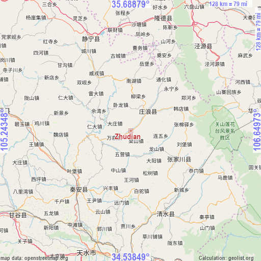
Zhudian GPS coordinates[2]
35° 6' 56.412" North, 105° 56' 47.76" East
| Map corner | latitude | longitude |
|---|---|---|
| Upper-left | 35.68879°, | 105.24348° |
| Center: | 35.11567°, | 105.9466° |
| Lower-right: | 34.53849°, | 106.64973° |
| Map W x H: | 127.9×127.9 km | = 79.5×79.5mi |
| max Lat: | 53.31946° ⇑24.7% North |
| Zhudian: | 35.11567° |
| min Lat: | ⇓75.3% South 18.22056° |
| min Long | Zhudian | max Long |
| 75.07348° | 105.9466° | 134.28917° |
| W 12.9%⇐ | ⇒87.1% E |
Elevation
Elevation of Zhudian is 1507 m = 4944 ft, and this is 1022.2 m = 3354 ft above average elevation for this country.
| Max E: |
5622 m = 18445 ft | 8.5% |
| Zhudian | 1507 m 4944 ft | |
| Avg. | 484.8 m = 1591 ft | |
Min E: |
-3 m = -10 ft | 91.5% |
See also: China elevation on elevation.city.
Geographical zone
Zhudian is located in North temperate zone (between Tropic of Cancer and the Arctic Circle). Distance of this Northern Tropic circle is 1298.6 km =806.9 mi to South.| Distance of | km | miles | from Zhudian |
|---|---|---|---|
| North Pole | 6102.6 | 3792 | to North |
| Arctic Circle | 3496.7 | 2172.7 | to North |
| Tropic Cancer | 1298.6 | 806.9 | to South |
| Equator | 3904.5 | 2426.1 | to South |


Nearby cities:
15 places around Zhudian: (largest is in red/bold)
• Haodi
21.3 km =13.2 mi,  233°
233°
• Jichuan
43.9 km =27.3 mi,  275°
275°
• Liangshan
5.3 km =3.3 mi,  152°
152°
• Lianhua
15.4 km =9.6 mi,  246°
246°
• Lidian
26.6 km =16.5 mi,  297°
297°
• Liuping
32.4 km =20.1 mi,  219°
219°
• Longcheng
13 km =8.1 mi,  169°
169°
• Nanhu
24.7 km =15.3 mi,  2°
2°
• Wangpu
46.9 km =29.1 mi,  262°
262°
• Wangyin
35.6 km =22.1 mi,  208°
208°
• Weirong
32.7 km =20.3 mi,  328°
328°
• Xindian
47 km =29.2 mi, 304°
• Xingguo
38.2 km =23.7 mi, 221°
• Yongqing
44.1 km =27.4 mi,  158°
158°
• Zhangjiachuan
27.8 km =17.3 mi,  120°
120°
Sources, notices
• [Note1] Compared only with cities in China existing in our database
• [Src1] Map data: © OpenStreetMap contributors (CC-BY-SA)
• [Src2] Other city data from geonames.org with taken over terms of usage.
• [Src3] Geographical zone / Annual Mean Temperature by Robert A. Rohde @ Wikipedia
