Zhongtou geodata
Zhongtou (Henan) is a seat of a fourth-order administrative division; located in China in Asia/Shanghai (GMT+8) time zone. In our database, there are 1268 cities with bigger population. Compared to other cities in China, 70% of cities are located further ↓South; 55.4% of cities are located further →East and 58.2% of cities have higher elevation than Zhongtou. Note1


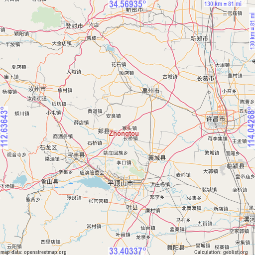
Zhongtou GPS coordinates[2]
33° 59' 18.096" North, 113° 20' 22.38" East
| Map corner | latitude | longitude |
|---|---|---|
| Upper-left | 34.56935°, | 112.63643° |
| Center: | 33.98836°, | 113.33955° |
| Lower-right: | 33.40337°, | 114.04268° |
| Map W x H: | 129.6×129.6 km | = 80.5×80.5mi |
| max Lat: | 53.31946° ⇑30% North |
| Zhongtou: | 33.98836° |
| min Lat: | ⇓70% South 18.22056° |
| min Long | Zhongtou | max Long |
| 75.07348° | 113.33955° | 134.28917° |
| W 44.6%⇐ | ⇒55.4% E |
Elevation
Elevation of Zhongtou is 110 m = 361 ft, and this is 374.8 m = 1230 ft below average elevation for this country.
| Max E: |
5622 m = 18445 ft | 58.2% |
| Avg. | 484.8 m = 1591 ft | |
| Zhongtou | 110 m = 361 ft | |
Min E: |
-3 m = -10 ft | 41.8% |
See also: China elevation on elevation.city.
Geographical zone
Zhongtou is located in North temperate zone (between Tropic of Cancer and the Arctic Circle). Distance of this Northern Tropic circle is 1173.2 km =729 mi to South.| Distance of | km | miles | from Zhongtou |
|---|---|---|---|
| North Pole | 6227.9 | 3869.8 | to North |
| Arctic Circle | 3622 | 2250.6 | to North |
| Tropic Cancer | 1173.2 | 729 | to South |
| Equator | 3779.2 | 2348.3 | to South |


Nearby cities:
15 places around Zhongtou: (largest is in red/bold)
• Anliang
9.5 km =5.9 mi,  311°
311°
• Changqiao
5.8 km =3.6 mi,  172°
172°
• Fenchen
17.7 km =11 mi,  96°
96°
• Guangkuotiandi
16.2 km =10.1 mi,  261°
261°
• Huangdao
18.8 km =11.7 mi,  297°
297°
• Jiaxian
12.3 km =7.6 mi, 259°
• Lizhuang
17.7 km =11 mi,  202°
202°
• Naodian
19 km =11.8 mi,  218°
218°
• Shilipu
14.5 km =9 mi,  144°
144°
• Shiqiao
18.5 km =11.5 mi,  246°
246°
• Tangjie
10.3 km =6.4 mi,  192°
192°
• Wangluo
13.1 km =8.1 mi, 100°
• Xiangcheng Chengguanzhen
20.2 km =12.6 mi, 140°
• Yaozhuang
14 km =8.7 mi,  206°
206°
• Ziyun
20.5 km =12.7 mi,  156°
156°
Sources, notices
• [Note1] Compared only with cities in China existing in our database
• [Src1] Map data: © OpenStreetMap contributors (CC-BY-SA)
• [Src2] Other city data from geonames.org with taken over terms of usage.
• [Src3] Geographical zone / Annual Mean Temperature by Robert A. Rohde @ Wikipedia
