Anliang geodata
Anliang (Henan) is a seat of a fourth-order administrative division; located in China in Asia/Shanghai (GMT+8) time zone. In our database, there are 1268 cities with bigger population. Compared to other cities in China, 70.2% of cities are located further ↓South; 55.9% of cities are located further →East and 54.9% of cities have higher elevation than Anliang. Note1


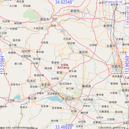
Anliang GPS coordinates[2]
34° 2' 41.568" North, 113° 15' 45.216" East
| Map corner | latitude | longitude |
|---|---|---|
| Upper-left | 34.62548°, | 112.55944° |
| Center: | 34.04488°, | 113.26256° |
| Lower-right: | 33.46028°, | 113.96569° |
| Map W x H: | 129.6×129.6 km | = 80.5×80.5mi |
| max Lat: | 53.31946° ⇑29.8% North |
| Anliang: | 34.04488° |
| min Lat: | ⇓70.2% South 18.22056° |
| min Long | Anliang | max Long |
| 75.07348° | 113.26256° | 134.28917° |
| W 44.1%⇐ | ⇒55.9% E |
Elevation
Elevation of Anliang is 132 m = 433 ft, and this is 352.8 m = 1157 ft below average elevation for this country.
| Max E: |
5622 m = 18445 ft | 54.9% |
| Avg. | 484.8 m = 1591 ft | |
| Anliang | 132 m = 433 ft | |
Min E: |
-3 m = -10 ft | 45.1% |
See also: China elevation on elevation.city.
Geographical zone
Anliang is located in North temperate zone (between Tropic of Cancer and the Arctic Circle). Distance of this Northern Tropic circle is 1179.5 km =732.9 mi to South.| Distance of | km | miles | from Anliang |
|---|---|---|---|
| North Pole | 6221.6 | 3865.9 | to North |
| Arctic Circle | 3615.7 | 2246.7 | to North |
| Tropic Cancer | 1179.5 | 732.9 | to South |
| Equator | 3785.4 | 2352.1 | to South |


Nearby cities:
15 places around Anliang: (largest is in red/bold)
• Changqiao
14.4 km =8.9 mi,  146°
146°
• Ciba
19.6 km =12.2 mi,  281°
281°
• Guangkuotiandi
12.5 km =7.8 mi,  225°
225°
• Huangdao
9.9 km =6.2 mi,  285°
285°
• Jiaxian
9.9 km =6.2 mi,  210°
210°
• Lizhuang
22.6 km =14 mi,  179°
179°
• Naodian
21.7 km =13.5 mi,  192°
192°
• Shiqiao
17 km =10.6 mi,  215°
215°
• Tangjie
17.1 km =10.6 mi,  163°
163°
• Wangluo
21.8 km =13.5 mi,  113°
113°
• Xiaoqi
23.5 km =14.6 mi, 232°
• Xuedian
16.6 km =10.3 mi,  257°
257°
• Yaozhuang
18.8 km =11.7 mi, 177°
• Yingchuan
22.7 km =14.1 mi,  54°
54°
• Zhongtou
9.5 km =5.9 mi,  131°
131°
Sources, notices
• [Note1] Compared only with cities in China existing in our database
• [Src1] Map data: © OpenStreetMap contributors (CC-BY-SA)
• [Src2] Other city data from geonames.org with taken over terms of usage.
• [Src3] Geographical zone / Annual Mean Temperature by Robert A. Rohde @ Wikipedia
