Jinzhong geodata
Jinzhong (Yunnan) is a seat of a third-order administrative division; located in China in Asia/Shanghai (GMT+8) time zone. In our database, there are 1268 cities with bigger population. Compared to other cities in China, 80.9% of cities are located further ↑North; 91.1% of cities are located further →East and 96.6% of cities have lower elevation than Jinzhong. Note1


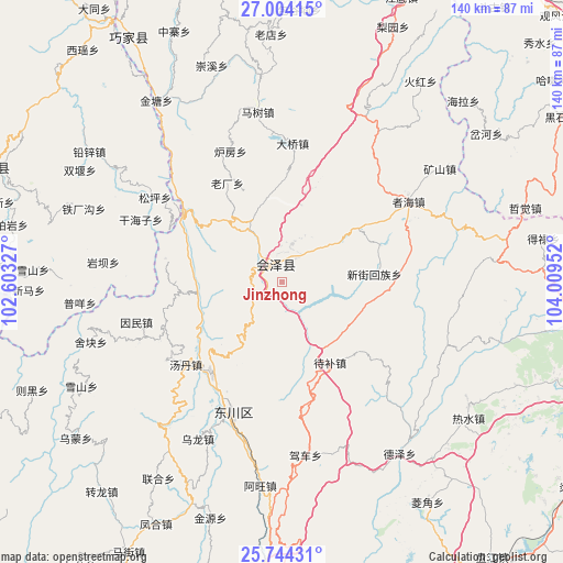
Jinzhong GPS coordinates[2]
26° 22' 33.42" North, 103° 18' 23.004" East
| Map corner | latitude | longitude |
|---|---|---|
| Upper-left | 27.00415°, | 102.60327° |
| Center: | 26.37595°, | 103.30639° |
| Lower-right: | 25.74431°, | 104.00952° |
| Map W x H: | 140.1×140.1 km | = 87.1×87.1mi |
| max Lat: | 53.31946° ⇑80.9% North |
| Jinzhong: | 26.37595° |
| min Lat: | ⇓19.1% South 18.22056° |
| min Long | Jinzhong | max Long |
| 75.07348° | 103.30639° | 134.28917° |
| W 8.9%⇐ | ⇒91.1% E |
Elevation
Elevation of Jinzhong is 2874 m = 9429 ft, and this is 2389.2 m = 7839 ft above average elevation for this country.
| Max E: |
5622 m = 18445 ft | 3.4% |
| Jinzhong | 2874 m 9429 ft | |
| Avg. | 484.8 m = 1591 ft | |
Min E: |
-3 m = -10 ft | 96.6% |
See also: China elevation on elevation.city.
Geographical zone
Jinzhong is located in North temperate zone (between Tropic of Cancer and the Arctic Circle). Distance of this Northern Tropic circle is 326.8 km =203.1 mi to South.| Distance of | km | miles | from Jinzhong |
|---|---|---|---|
| North Pole | 7074.3 | 4395.8 | to North |
| Arctic Circle | 4468.4 | 2776.5 | to North |
| Tropic Cancer | 326.8 | 203.1 | to South |
| Equator | 2932.7 | 1822.3 | to South |


Nearby cities:
15 places around Jinzhong: (largest is in red/bold)
• Chenggan
56.4 km =35 mi,  242°
242°
• Dasongshu
37.6 km =23.4 mi,  134°
134°
• Dianweijie
68.9 km =42.8 mi,  220°
220°
• Gangou
22.1 km =13.7 mi,  314°
314°
• Jiezi
55.6 km =34.5 mi,  325°
325°
• Kaji
64.5 km =40.1 mi,  233°
233°
• Laodianzi
61.7 km =38.3 mi,  358°
358°
• Laofangzi
34.9 km =21.7 mi,  340°
340°
• Laojie
34.1 km =21.2 mi, 310°
• Laojiezi
56.9 km =35.4 mi, 342°
• Shanzidi
20.3 km =12.6 mi,  346°
346°
• Shuigou
67.9 km =42.2 mi, 337°
• Xiangyang
43 km =26.7 mi, 353°
• Xiaotiechang
34.7 km =21.6 mi,  107°
107°
• Xinhua
68 km =42.3 mi, 326°
Sources, notices
• [Note1] Compared only with cities in China existing in our database
• [Src1] Map data: © OpenStreetMap contributors (CC-BY-SA)
• [Src2] Other city data from geonames.org with taken over terms of usage.
• [Src3] Geographical zone / Annual Mean Temperature by Robert A. Rohde @ Wikipedia
