Chenggan geodata
Chenggan (Yunnan) is a seat of a fourth-order administrative division; located in China in Asia/Shanghai (GMT+8) time zone. In our database, there are 1268 cities with bigger population. Compared to other cities in China, 81.7% of cities are located further ↑North; 91.9% of cities are located further →East and 96.1% of cities have lower elevation than Chenggan. Note1


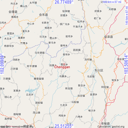
Chenggan GPS coordinates[2]
26° 8' 43.548" North, 102° 48' 10.836" East
| Map corner | latitude | longitude |
|---|---|---|
| Upper-left | 26.77489°, | 102.09989° |
| Center: | 26.14543°, | 102.80301° |
| Lower-right: | 25.51255°, | 103.50614° |
| Map W x H: | 140.4×140.4 km | = 87.2×87.2mi |
| max Lat: | 53.31946° ⇑81.7% North |
| Chenggan: | 26.14543° |
| min Lat: | ⇓18.3% South 18.22056° |
| min Long | Chenggan | max Long |
| 75.07348° | 102.80301° | 134.28917° |
| W 8.1%⇐ | ⇒91.9% E |
Elevation
Elevation of Chenggan is 2601 m = 8533 ft, and this is 2116.2 m = 6943 ft above average elevation for this country.
| Max E: |
5622 m = 18445 ft | 3.9% |
| Chenggan | 2601 m 8533 ft | |
| Avg. | 484.8 m = 1591 ft | |
Min E: |
-3 m = -10 ft | 96.1% |
See also: China elevation on elevation.city.
Geographical zone
Chenggan is located in North temperate zone (between Tropic of Cancer and the Arctic Circle). Distance of this Northern Tropic circle is 301.2 km =187.2 mi to South.| Distance of | km | miles | from Chenggan |
|---|---|---|---|
| North Pole | 7100 | 4411.7 | to North |
| Arctic Circle | 4494.1 | 2792.5 | to North |
| Tropic Cancer | 301.2 | 187.2 | to South |
| Equator | 2907.1 | 1806.4 | to South |


Nearby cities:
15 places around Chenggan: (largest is in red/bold)
• Dasongshu
76.9 km =47.8 mi,  90°
90°
• Dianweijie
26.9 km =16.7 mi,  169°
169°
• Gangou
53.6 km =33.3 mi,  39°
39°
• Huidong
59.2 km =36.8 mi,  337°
337°
• Jiaoxiyakou
35.3 km =21.9 mi,  266°
266°
• Jiezi
74 km =46 mi,  14°
14°
• Jinzhong
56.4 km =35 mi,  62°
62°
• Kaji
13.1 km =8.1 mi,  186°
186°
• Laofangzi
70 km =43.5 mi,  33°
33°
• Laojie
53.8 km =33.4 mi, 26°
• Laojiezi
24.3 km =15.1 mi, 270°
• Maoshanjie
61.2 km =38 mi,  209°
209°
• Muzeng
33.9 km =21.1 mi,  252°
252°
• Pujiawan
51.2 km =31.8 mi, 274°
• Shanzidi
64.3 km =40 mi,  45°
45°
Sources, notices
• [Note1] Compared only with cities in China existing in our database
• [Src1] Map data: © OpenStreetMap contributors (CC-BY-SA)
• [Src2] Other city data from geonames.org with taken over terms of usage.
• [Src3] Geographical zone / Annual Mean Temperature by Robert A. Rohde @ Wikipedia
