Dasongshu geodata
Dasongshu (Yunnan) is a seat of a fourth-order administrative division; located in China in Asia/Shanghai (GMT+8) time zone. In our database, there are 1268 cities with bigger population. Compared to other cities in China, 81.8% of cities are located further ↑North; 90.8% of cities are located further →East and 93.6% of cities have lower elevation than Dasongshu. Note1


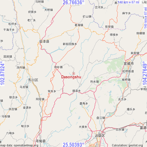
Dasongshu GPS coordinates[2]
26° 8' 12.66" North, 103° 34' 24.096" East
| Map corner | latitude | longitude |
|---|---|---|
| Upper-left | 26.76636°, | 102.87024° |
| Center: | 26.13685°, | 103.57336° |
| Lower-right: | 25.50393°, | 104.27649° |
| Map W x H: | 140.4×140.4 km | = 87.2×87.2mi |
| max Lat: | 53.31946° ⇑81.8% North |
| Dasongshu: | 26.13685° |
| min Lat: | ⇓18.2% South 18.22056° |
| min Long | Dasongshu | max Long |
| 75.07348° | 103.57336° | 134.28917° |
| W 9.2%⇐ | ⇒90.8% E |
Elevation
Elevation of Dasongshu is 1807 m = 5928 ft, and this is 1322.2 m = 4338 ft above average elevation for this country.
| Max E: |
5622 m = 18445 ft | 6.4% |
| Dasongshu | 1807 m 5928 ft | |
| Avg. | 484.8 m = 1591 ft | |
Min E: |
-3 m = -10 ft | 93.6% |
See also: China elevation on elevation.city.
Geographical zone
Dasongshu is located in North temperate zone (between Tropic of Cancer and the Arctic Circle). Distance of this Northern Tropic circle is 300.2 km =186.5 mi to South.| Distance of | km | miles | from Dasongshu |
|---|---|---|---|
| North Pole | 7100.9 | 4412.3 | to North |
| Arctic Circle | 4495 | 2793.1 | to North |
| Tropic Cancer | 300.2 | 186.5 | to South |
| Equator | 2906.1 | 1805.8 | to South |


Nearby cities:
15 places around Dasongshu: (largest is in red/bold)
• Chengfangqiao
49.4 km =30.7 mi,  148°
148°
• Chenggan
76.9 km =47.8 mi,  270°
270°
• Dianweijie
76.2 km =47.3 mi,  250°
250°
• Gangou
59.7 km =37.1 mi,  314°
314°
• Jianxincun
63.9 km =39.7 mi,  121°
121°
• Jinzhong
37.6 km =23.4 mi, 314°
• Laofangzi
70.8 km =44 mi,  327°
327°
• Laojie
71.7 km =44.6 mi, 313°
• Machang
69.4 km =43.1 mi,  92°
92°
• Qujing
75.6 km =47 mi,  163°
163°
• Rende
70.9 km =44.1 mi,  204°
204°
• Shanzidi
55.9 km =34.7 mi, 326°
• Xiangyang
76.2 km =47.3 mi,  335°
335°
• Xiaotiechang
17.6 km =10.9 mi,  21°
21°
• Xiping
63.9 km =39.7 mi, 159°
Sources, notices
• [Note1] Compared only with cities in China existing in our database
• [Src1] Map data: © OpenStreetMap contributors (CC-BY-SA)
• [Src2] Other city data from geonames.org with taken over terms of usage.
• [Src3] Geographical zone / Annual Mean Temperature by Robert A. Rohde @ Wikipedia
