Yunling geodata
Yunling (Anhui) is a seat of a fourth-order administrative division; located in China in Asia/Shanghai (GMT+8) time zone. In our database, there are 1268 cities with bigger population. Compared to other cities in China, 51.6% of cities are located further ↓South; 71.6% of cities are located further ←West and 63.7% of cities have higher elevation than Yunling. Note1


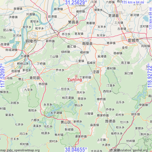
Yunling GPS coordinates[2]
30° 39' 11.916" North, 118° 13' 26.724" East
| Map corner | latitude | longitude |
|---|---|---|
| Upper-left | 31.25629°, | 117.52097° |
| Center: | 30.65331°, | 118.22409° |
| Lower-right: | 30.04655°, | 118.92722° |
| Map W x H: | 134.5×134.5 km | = 83.6×83.6mi |
| max Lat: | 53.31946° ⇑48.4% North |
| Yunling: | 30.65331° |
| min Lat: | ⇓51.6% South 18.22056° |
| min Long | Yunling | max Long |
| 75.07348° | 118.22409° | 134.28917° |
| W 71.6%⇐ | ⇒28.4% E |
Elevation
Elevation of Yunling is 79 m = 259 ft, and this is 405.8 m = 1331 ft below average elevation for this country.
| Max E: |
5622 m = 18445 ft | 63.7% |
| Avg. | 484.8 m = 1591 ft | |
| Yunling | 79 m = 259 ft | |
Min E: |
-3 m = -10 ft | 36.3% |
See also: China elevation on elevation.city.
Geographical zone
Yunling is located in North temperate zone (between Tropic of Cancer and the Arctic Circle). Distance of this Northern Tropic circle is 802.4 km =498.6 mi to South.| Distance of | km | miles | from Yunling |
|---|---|---|---|
| North Pole | 6598.7 | 4100.2 | to North |
| Arctic Circle | 3992.8 | 2481 | to North |
| Tropic Cancer | 802.4 | 498.6 | to South |
| Equator | 3408.3 | 2117.8 | to South |


Nearby cities:
15 places around Yunling: (largest is in red/bold)
• Anwu
7.6 km =4.7 mi,  162°
162°
• Baocun
14.6 km =9.1 mi,  220°
220°
• Beigong
3.9 km =2.4 mi,  322°
322°
• Dingjiaqiao
8.1 km =5 mi,  96°
96°
• Gufeng
18.1 km =11.2 mi,  48°
48°
• Huangcun
11 km =6.8 mi,  116°
116°
• Jingchuan
17.7 km =11 mi,  76°
76°
• Maolin
16.2 km =10.1 mi,  171°
171°
• Qiaomu
15.1 km =9.4 mi,  291°
291°
• Sanli
13.9 km =8.6 mi,  12°
12°
• Taiyuan
18 km =11.2 mi,  69°
69°
• Taohuatan
19.8 km =12.3 mi,  202°
202°
• Yandun
9.9 km =6.2 mi, 320°
• Zhangdu
6.3 km =3.9 mi,  176°
176°
• Zhongcun
5.6 km =3.5 mi, 223°
Sources, notices
• [Note1] Compared only with cities in China existing in our database
• [Src1] Map data: © OpenStreetMap contributors (CC-BY-SA)
• [Src2] Other city data from geonames.org with taken over terms of usage.
• [Src3] Geographical zone / Annual Mean Temperature by Robert A. Rohde @ Wikipedia
