Jingchuan geodata
Jingchuan (Anhui) is a seat of a third-order administrative division; located in China in Asia/Shanghai (GMT+8) time zone. In our database, there are 1268 cities with bigger population. Compared to other cities in China, 52% of cities are located further ↓South; 72.6% of cities are located further ←West and 75.7% of cities have higher elevation than Jingchuan. Note1


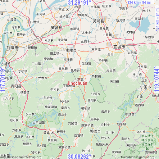
Jingchuan GPS coordinates[2]
30° 41' 20.976" North, 118° 24' 15.516" East
| Map corner | latitude | longitude |
|---|---|---|
| Upper-left | 31.29191°, | 117.70119° |
| Center: | 30.68916°, | 118.40431° |
| Lower-right: | 30.08262°, | 119.10744° |
| Map W x H: | 134.5×134.5 km | = 83.6×83.6mi |
| max Lat: | 53.31946° ⇑48% North |
| Jingchuan: | 30.68916° |
| min Lat: | ⇓52% South 18.22056° |
| min Long | Jingchuan | max Long |
| 75.07348° | 118.40431° | 134.28917° |
| W 72.6%⇐ | ⇒27.4% E |
Elevation
Elevation of Jingchuan is 35 m = 115 ft, and this is 449.8 m = 1476 ft below average elevation for this country.
| Max E: |
5622 m = 18445 ft | 75.7% |
| Avg. | 484.8 m = 1591 ft | |
| Jingchuan | 35 m = 115 ft | |
Min E: |
-3 m = -10 ft | 24.3% |
See also: China elevation on elevation.city.
Geographical zone
Jingchuan is located in North temperate zone (between Tropic of Cancer and the Arctic Circle). Distance of this Northern Tropic circle is 806.4 km =501.1 mi to South.| Distance of | km | miles | from Jingchuan |
|---|---|---|---|
| North Pole | 6594.7 | 4097.8 | to North |
| Arctic Circle | 3988.9 | 2478.6 | to North |
| Tropic Cancer | 806.4 | 501.1 | to South |
| Equator | 3412.3 | 2120.3 | to South |


Nearby cities:
15 places around Jingchuan: (largest is in red/bold)
• Anwu
18.7 km =11.6 mi,  233°
233°
• Beigong
19.6 km =12.2 mi,  267°
267°
• Caicun
14.3 km =8.9 mi,  77°
77°
• Changqiao
7.9 km =4.9 mi,  0°
0°
• Dingjiaqiao
10.4 km =6.5 mi,  242°
242°
• Gufeng
8.9 km =5.5 mi,  334°
334°
• Huangcun
11.6 km =7.2 mi,  219°
219°
• Qinxi
9.4 km =5.8 mi,  61°
61°
• Sanli
17.2 km =10.7 mi,  303°
303°
• Suhong
18.2 km =11.3 mi,  132°
132°
• Taiyuan
2.4 km =1.5 mi,  351°
351°
• Tongtuan
16.2 km =10.1 mi,  338°
338°
• Yangong
6.1 km =3.8 mi, 134°
• Yunling
17.7 km =11 mi,  256°
256°
• Zhangdu
19.8 km =12.3 mi, 238°
Sources, notices
• [Note1] Compared only with cities in China existing in our database
• [Src1] Map data: © OpenStreetMap contributors (CC-BY-SA)
• [Src2] Other city data from geonames.org with taken over terms of usage.
• [Src3] Geographical zone / Annual Mean Temperature by Robert A. Rohde @ Wikipedia
