Yun’an geodata
Yun’an (Chongqing) is a seat of a fourth-order administrative division; located in China in Asia/Shanghai (GMT+8) time zone. In our database, there are 1268 cities with bigger population. Compared to other cities in China, 55.2% of cities are located further ↓South; 77% of cities are located further →East and 56.4% of cities have lower elevation than Yun’an. Note1


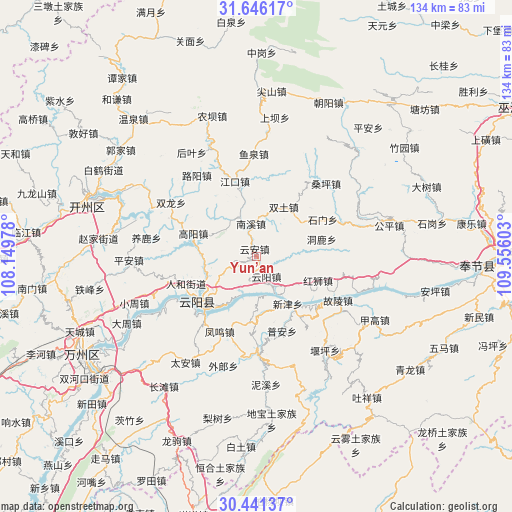
Yun’an GPS coordinates[2]
31° 2' 44.448" North, 108° 51' 10.44" East
| Map corner | latitude | longitude |
|---|---|---|
| Upper-left | 31.64617°, | 108.14978° |
| Center: | 31.04568°, | 108.8529° |
| Lower-right: | 30.44137°, | 109.55603° |
| Map W x H: | 134×134 km | = 83.3×83.3mi |
| max Lat: | 53.31946° ⇑44.8% North |
| Yun’an: | 31.04568° |
| min Lat: | ⇓55.2% South 18.22056° |
| min Long | Yun’an | max Long |
| 75.07348° | 108.8529° | 134.28917° |
| W 23%⇐ | ⇒77% E |
Elevation
Elevation of Yun’an is 220 m = 722 ft, and this is 264.8 m = 869 ft below average elevation for this country.
| Max E: |
5622 m = 18445 ft | 43.6% |
| Avg. | 484.8 m = 1591 ft | |
| Yun’an | 220 m = 722 ft | |
Min E: |
-3 m = -10 ft | 56.4% |
See also: China elevation on elevation.city.
Geographical zone
Yun’an is located in North temperate zone (between Tropic of Cancer and the Arctic Circle). Distance of this Northern Tropic circle is 846 km =525.7 mi to South.| Distance of | km | miles | from Yun’an |
|---|---|---|---|
| North Pole | 6555.1 | 4073.1 | to North |
| Arctic Circle | 3949.2 | 2453.9 | to North |
| Tropic Cancer | 846 | 525.7 | to South |
| Equator | 3452 | 2145 | to South |


Nearby cities:
15 places around Yun’an: (largest is in red/bold)
• Baoping
18 km =11.2 mi,  180°
180°
• Donglu
18.4 km =11.4 mi,  74°
74°
• Gaoyang
17.6 km =10.9 mi,  289°
289°
• Hongshi
17.6 km =10.9 mi,  111°
111°
• Huangshi
13.8 km =8.6 mi,  248°
248°
• Jiangkou
20.4 km =12.7 mi,  344°
344°
• Nanxi
7.7 km =4.8 mi,  348°
348°
• Panlong
20.6 km =12.8 mi,  221°
221°
• Qinglong
19.4 km =12.1 mi,  229°
229°
• Renhe
19.6 km =12.2 mi, 249°
• Shimen
20 km =12.4 mi,  61°
61°
• Shuangjiang
20 km =12.4 mi, 234°
• Shuikou
9.6 km =6 mi,  242°
242°
• Taiyang
19.9 km =12.4 mi,  48°
48°
• Yunyang
6 km =3.7 mi,  152°
152°
Sources, notices
• [Note1] Compared only with cities in China existing in our database
• [Src1] Map data: © OpenStreetMap contributors (CC-BY-SA)
• [Src2] Other city data from geonames.org with taken over terms of usage.
• [Src3] Geographical zone / Annual Mean Temperature by Robert A. Rohde @ Wikipedia
