Yugan geodata
Yugan (Jiangxi) is a seat of a fourth-order administrative division; located in China in Asia/Shanghai (GMT+8) time zone. In our database, there are 1268 cities with bigger population. Compared to other cities in China, 68% of cities are located further ↑North; 64.2% of cities are located further ←West and 71.3% of cities have higher elevation than Yugan. Note1


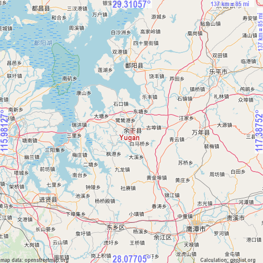
Yugan GPS coordinates[2]
28° 41' 44.268" North, 116° 41' 3.804" East
| Map corner | latitude | longitude |
|---|---|---|
| Upper-left | 29.31057°, | 115.98127° |
| Center: | 28.69563°, | 116.68439° |
| Lower-right: | 28.07705°, | 117.38752° |
| Map W x H: | 137.2×137.2 km | = 85.3×85.3mi |
| max Lat: | 53.31946° ⇑68% North |
| Yugan: | 28.69563° |
| min Lat: | ⇓32% South 18.22056° |
| min Long | Yugan | max Long |
| 75.07348° | 116.68439° | 134.28917° |
| W 64.2%⇐ | ⇒35.8% E |
Elevation
Elevation of Yugan is 47 m = 154 ft, and this is 437.8 m = 1436 ft below average elevation for this country.
| Max E: |
5622 m = 18445 ft | 71.3% |
| Avg. | 484.8 m = 1591 ft | |
| Yugan | 47 m = 154 ft | |
Min E: |
-3 m = -10 ft | 28.7% |
See also: China elevation on elevation.city.
Geographical zone
Yugan is located in North temperate zone (between Tropic of Cancer and the Arctic Circle). Distance of this Northern Tropic circle is 584.7 km =363.3 mi to South.| Distance of | km | miles | from Yugan |
|---|---|---|---|
| North Pole | 6816.4 | 4235.5 | to North |
| Arctic Circle | 4210.5 | 2616.3 | to North |
| Tropic Cancer | 584.7 | 363.3 | to South |
| Equator | 3190.7 | 1982.6 | to South |


Nearby cities:
15 places around Yugan: (largest is in red/bold)
• Baimaqiao
8.1 km =5 mi,  139°
139°
• Datang
18.7 km =11.6 mi,  299°
299°
• Daxi
12 km =7.5 mi,  173°
173°
• Fenggang
14.8 km =9.2 mi,  220°
220°
• Gubu
11.7 km =7.3 mi,  78°
78°
• Heshan
16.8 km =10.4 mi,  229°
229°
• Hongjiazui
2.6 km =1.6 mi,  278°
278°
• Hualingang
1.5 km =0.9 mi,  35°
35°
• Huyunxiang
16.4 km =10.2 mi,  48°
48°
• Jiangbu
12.5 km =7.8 mi, 234°
• Jinshanzui
12.8 km =8 mi,  289°
289°
• Lusigang
7.3 km =4.5 mi,  332°
332°
• Qibu
17.7 km =11 mi, 80°
• Santang
12.2 km =7.6 mi, 291°
• Shikou
15.9 km =9.9 mi,  338°
338°
Sources, notices
• [Note1] Compared only with cities in China existing in our database
• [Src1] Map data: © OpenStreetMap contributors (CC-BY-SA)
• [Src2] Other city data from geonames.org with taken over terms of usage.
• [Src3] Geographical zone / Annual Mean Temperature by Robert A. Rohde @ Wikipedia
