Huyunxiang geodata
Huyunxiang (Jiangxi) is a seat of a fourth-order administrative division; located in China in Asia/Shanghai (GMT+8) time zone. In our database, there are 1268 cities with bigger population. Compared to other cities in China, 67.2% of cities are located further ↑North; 65% of cities are located further ←West and 82.1% of cities have higher elevation than Huyunxiang. Note1


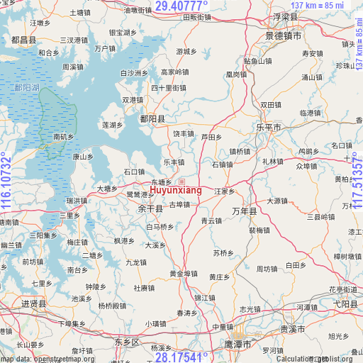
Huyunxiang GPS coordinates[2]
28° 47' 36.276" North, 116° 48' 37.584" East
| Map corner | latitude | longitude |
|---|---|---|
| Upper-left | 29.40777°, | 116.10732° |
| Center: | 28.79341°, | 116.81044° |
| Lower-right: | 28.17541°, | 117.51357° |
| Map W x H: | 137×137 km | = 85.1×85.1mi |
| max Lat: | 53.31946° ⇑67.2% North |
| Huyunxiang: | 28.79341° |
| min Lat: | ⇓32.8% South 18.22056° |
| min Long | Huyunxiang | max Long |
| 75.07348° | 116.81044° | 134.28917° |
| W 65%⇐ | ⇒35% E |
Elevation
Elevation of Huyunxiang is 22 m = 72 ft, and this is 462.8 m = 1518 ft below average elevation for this country.
| Max E: |
5622 m = 18445 ft | 82.1% |
| Avg. | 484.8 m = 1591 ft | |
| Huyunxiang | 22 m = 72 ft | |
Min E: |
-3 m = -10 ft | 17.9% |
See also: China elevation on elevation.city.
Geographical zone
Huyunxiang is located in North temperate zone (between Tropic of Cancer and the Arctic Circle). Distance of this Northern Tropic circle is 595.6 km =370.1 mi to South.| Distance of | km | miles | from Huyunxiang |
|---|---|---|---|
| North Pole | 6805.5 | 4228.7 | to North |
| Arctic Circle | 4199.6 | 2609.5 | to North |
| Tropic Cancer | 595.6 | 370.1 | to South |
| Equator | 3201.5 | 1989.3 | to South |


Nearby cities:
15 places around Huyunxiang: (largest is in red/bold)
• Dahuang
12 km =7.5 mi,  95°
95°
• Gubu
8.5 km =5.3 mi,  185°
185°
• Hongjiazui
18.2 km =11.3 mi,  234°
234°
• Hualingang
15 km =9.3 mi, 229°
• Lefengzhen
8.4 km =5.2 mi,  338°
338°
• Lusigang
16.2 km =10.1 mi,  254°
254°
• Qibu
9.5 km =5.9 mi,  146°
146°
• Qingyun
18.4 km =11.4 mi,  142°
142°
• Raobu
16.4 km =10.2 mi,  54°
54°
• Raofeng
18.1 km =11.2 mi,  2°
2°
• Shizhen
16.6 km =10.3 mi,  65°
65°
• Tongshanxiang
5.4 km =3.4 mi, 344°
• Wangjia
15.6 km =9.7 mi,  126°
126°
• Yugan
16.4 km =10.2 mi, 228°
• Zibu
8.4 km =5.2 mi,  37°
37°
Sources, notices
• [Note1] Compared only with cities in China existing in our database
• [Src1] Map data: © OpenStreetMap contributors (CC-BY-SA)
• [Src2] Other city data from geonames.org with taken over terms of usage.
• [Src3] Geographical zone / Annual Mean Temperature by Robert A. Rohde @ Wikipedia
