Lusigang geodata
Lusigang (Jiangxi) is a seat of a fourth-order administrative division; located in China in Asia/Shanghai (GMT+8) time zone. In our database, there are 1268 cities with bigger population. Compared to other cities in China, 67.4% of cities are located further ↑North; 64% of cities are located further ←West and 84.3% of cities have higher elevation than Lusigang. Note1


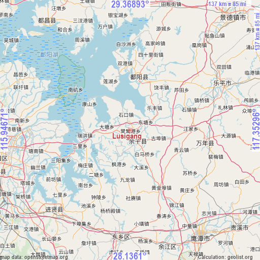
Lusigang GPS coordinates[2]
28° 45' 15.588" North, 116° 38' 59.388" East
| Map corner | latitude | longitude |
|---|---|---|
| Upper-left | 29.36893°, | 115.94671° |
| Center: | 28.75433°, | 116.64983° |
| Lower-right: | 28.1361°, | 117.35296° |
| Map W x H: | 137.1×137.1 km | = 85.2×85.2mi |
| max Lat: | 53.31946° ⇑67.4% North |
| Lusigang: | 28.75433° |
| min Lat: | ⇓32.6% South 18.22056° |
| min Long | Lusigang | max Long |
| 75.07348° | 116.64983° | 134.28917° |
| W 64%⇐ | ⇒36% E |
Elevation
Elevation of Lusigang is 17 m = 56 ft, and this is 467.8 m = 1535 ft below average elevation for this country.
| Max E: |
5622 m = 18445 ft | 84.3% |
| Avg. | 484.8 m = 1591 ft | |
| Lusigang | 17 m = 56 ft | |
Min E: |
-3 m = -10 ft | 15.7% |
See also: China elevation on elevation.city.
Geographical zone
Lusigang is located in North temperate zone (between Tropic of Cancer and the Arctic Circle). Distance of this Northern Tropic circle is 591.3 km =367.4 mi to South.| Distance of | km | miles | from Lusigang |
|---|---|---|---|
| North Pole | 6809.9 | 4231.5 | to North |
| Arctic Circle | 4204 | 2612.2 | to North |
| Tropic Cancer | 591.3 | 367.4 | to South |
| Equator | 3197.2 | 1986.6 | to South |


Nearby cities:
15 places around Lusigang: (largest is in red/bold)
• Baimaqiao
15.3 km =9.5 mi,  145°
145°
• Datang
13.1 km =8.1 mi,  282°
282°
• Daxi
19.1 km =11.9 mi,  165°
165°
• Fenggang
18.9 km =11.7 mi,  199°
199°
• Gubu
15.4 km =9.6 mi,  105°
105°
• Hongjiazui
6.2 km =3.9 mi, 172°
• Hualingang
6.8 km =4.2 mi,  141°
141°
• Huyunxiang
16.2 km =10.1 mi,  74°
74°
• Jiangbu
15.3 km =9.5 mi,  206°
206°
• Jinshanzui
9 km =5.6 mi,  255°
255°
• Lefengzhen
17.5 km =10.9 mi,  46°
46°
• Santang
8.3 km =5.2 mi, 255°
• Shikou
8.7 km =5.4 mi,  343°
343°
• Tongshanxiang
17.1 km =10.6 mi,  56°
56°
• Yugan
7.3 km =4.5 mi, 152°
Sources, notices
• [Note1] Compared only with cities in China existing in our database
• [Src1] Map data: © OpenStreetMap contributors (CC-BY-SA)
• [Src2] Other city data from geonames.org with taken over terms of usage.
• [Src3] Geographical zone / Annual Mean Temperature by Robert A. Rohde @ Wikipedia
