Yuantan geodata
Yuantan (Guangdong) is a seat of a fourth-order administrative division; located in China in Asia/Shanghai (GMT+8) time zone. In our database, there are 1268 cities with bigger population. Compared to other cities in China, 91.4% of cities are located further ↑North; 56.3% of cities are located further →East and 82.1% of cities have higher elevation than Yuantan. Note1


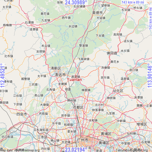
Yuantan GPS coordinates[2]
23° 40' 3" North, 113° 11' 53.988" East
| Map corner | latitude | longitude |
|---|---|---|
| Upper-left | 24.30989°, | 112.49521° |
| Center: | 23.6675°, | 113.19833° |
| Lower-right: | 23.02194°, | 113.90146° |
| Map W x H: | 143.2×143.2 km | = 89×89mi |
| max Lat: | 53.31946° ⇑91.4% North |
| Yuantan: | 23.6675° |
| min Lat: | ⇓8.6% South 18.22056° |
| min Long | Yuantan | max Long |
| 75.07348° | 113.19833° | 134.28917° |
| W 43.7%⇐ | ⇒56.3% E |
Elevation
Elevation of Yuantan is 22 m = 72 ft, and this is 462.8 m = 1518 ft below average elevation for this country.
| Max E: |
5622 m = 18445 ft | 82.1% |
| Avg. | 484.8 m = 1591 ft | |
| Yuantan | 22 m = 72 ft | |
Min E: |
-3 m = -10 ft | 17.9% |
See also: China elevation on elevation.city.
Geographical zone
Yuantan is located in North temperate zone (between Tropic of Cancer and the Arctic Circle). Distance of this Northern Tropic circle is 25.7 km =16 mi to South.| Distance of | km | miles | from Yuantan |
|---|---|---|---|
| North Pole | 7375.5 | 4582.9 | to North |
| Arctic Circle | 4769.6 | 2963.7 | to North |
| Tropic Cancer | 25.7 | 16 | to South |
| Equator | 2631.6 | 1635.2 | to South |


Nearby cities:
15 places around Yuantan: (largest is in red/bold)
• Aotou
22.7 km =14.1 mi,  103°
103°
• Dongcheng
16 km =9.9 mi,  296°
296°
• Feilaixia
10.9 km =6.8 mi,  20°
20°
• Fengcheng
18.7 km =11.6 mi,  293°
293°
• Gaotian
16.7 km =10.4 mi,  353°
353°
• Henghe
14.6 km =9.1 mi,  254°
254°
• Jiangkou
8.1 km =5 mi, 16°
• Longshan
21.4 km =13.3 mi,  64°
64°
• Longtang
15.1 km =9.4 mi,  239°
239°
• Qingyuan
17.2 km =10.7 mi,  282°
282°
• Shantang
24.9 km =15.5 mi,  262°
262°
• Shiling
23.9 km =14.9 mi,  191°
191°
• Taihe
23.7 km =14.7 mi, 288°
• Timian
16 km =9.9 mi,  145°
145°
• Zhouxin
11.6 km =7.2 mi, 279°
Sources, notices
• [Note1] Compared only with cities in China existing in our database
• [Src1] Map data: © OpenStreetMap contributors (CC-BY-SA)
• [Src2] Other city data from geonames.org with taken over terms of usage.
• [Src3] Geographical zone / Annual Mean Temperature by Robert A. Rohde @ Wikipedia
