Jiangkou geodata
Jiangkou (Guangdong) is a seat of a fourth-order administrative division; located in China in Asia/Shanghai (GMT+8) time zone. In our database, there are 1268 cities with bigger population. Compared to other cities in China, 91.1% of cities are located further ↑North; 56.2% of cities are located further →East and 85.5% of cities have higher elevation than Jiangkou. Note1


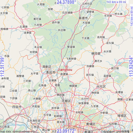
Jiangkou GPS coordinates[2]
23° 44' 12.984" North, 113° 13' 15.996" East
| Map corner | latitude | longitude |
|---|---|---|
| Upper-left | 24.37898°, | 112.51799° |
| Center: | 23.73694°, | 113.22111° |
| Lower-right: | 23.09172°, | 113.92424° |
| Map W x H: | 143.1×143.1 km | = 88.9×88.9mi |
| max Lat: | 53.31946° ⇑91.1% North |
| Jiangkou: | 23.73694° |
| min Lat: | ⇓8.9% South 18.22056° |
| min Long | Jiangkou | max Long |
| 75.07348° | 113.22111° | 134.28917° |
| W 43.8%⇐ | ⇒56.2% E |
Elevation
Elevation of Jiangkou is 15 m = 49 ft, and this is 469.8 m = 1541 ft below average elevation for this country.
| Max E: |
5622 m = 18445 ft | 85.5% |
| Avg. | 484.8 m = 1591 ft | |
| Jiangkou | 15 m = 49 ft | |
Min E: |
-3 m = -10 ft | 14.5% |
See also: China elevation on elevation.city.
Geographical zone
Jiangkou is located in North temperate zone (between Tropic of Cancer and the Arctic Circle). Distance of this Northern Tropic circle is 33.4 km =20.8 mi to South.| Distance of | km | miles | from Jiangkou |
|---|---|---|---|
| North Pole | 7367.8 | 4578.1 | to North |
| Arctic Circle | 4761.9 | 2958.9 | to North |
| Tropic Cancer | 33.4 | 20.8 | to South |
| Equator | 2639.3 | 1640 | to South |


Nearby cities:
15 places around Jiangkou: (largest is in red/bold)
• Aotou
23.6 km =14.7 mi,  123°
123°
• Dongcheng
16.6 km =10.3 mi,  268°
268°
• Feilaixia
2.9 km =1.8 mi,  29°
29°
• Fengcheng
19.4 km =12.1 mi, 269°
• Gaotian
9.8 km =6.1 mi,  335°
335°
• Henghe
20.1 km =12.5 mi,  234°
234°
• Lixi
23.5 km =14.6 mi,  8°
8°
• Longshan
17.1 km =10.6 mi,  84°
84°
• Longtang
21.7 km =13.5 mi, 225°
• Qingyuan
19.6 km =12.2 mi,  257°
257°
• Taihe
24.8 km =15.4 mi, 269°
• Tangtang
25.1 km =15.6 mi,  88°
88°
• Timian
21.9 km =13.6 mi,  161°
161°
• Yuantan
8.1 km =5 mi,  196°
196°
• Zhouxin
15 km =9.3 mi,  246°
246°
Sources, notices
• [Note1] Compared only with cities in China existing in our database
• [Src1] Map data: © OpenStreetMap contributors (CC-BY-SA)
• [Src2] Other city data from geonames.org with taken over terms of usage.
• [Src3] Geographical zone / Annual Mean Temperature by Robert A. Rohde @ Wikipedia
