Yanyang geodata
Yanyang (Guangdong) is a seat of a fourth-order administrative division; located in China in Asia/Shanghai (GMT+8) time zone. In our database, there are 1268 cities with bigger population. Compared to other cities in China, 88.8% of cities are located further ↑North; 61.9% of cities are located further ←West and 61.5% of cities have higher elevation than Yanyang. Note1


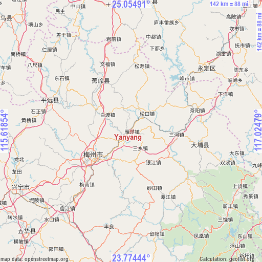
Yanyang GPS coordinates[2]
24° 24' 58.68" North, 116° 19' 17.976" East
| Map corner | latitude | longitude |
|---|---|---|
| Upper-left | 25.05491°, | 115.61854° |
| Center: | 24.4163°, | 116.32166° |
| Lower-right: | 23.77444°, | 117.02479° |
| Map W x H: | 142.4×142.4 km | = 88.5×88.5mi |
| max Lat: | 53.31946° ⇑88.8% North |
| Yanyang: | 24.4163° |
| min Lat: | ⇓11.2% South 18.22056° |
| min Long | Yanyang | max Long |
| 75.07348° | 116.32166° | 134.28917° |
| W 61.9%⇐ | ⇒38.1% E |
Elevation
Elevation of Yanyang is 90 m = 295 ft, and this is 394.8 m = 1295 ft below average elevation for this country.
| Max E: |
5622 m = 18445 ft | 61.5% |
| Avg. | 484.8 m = 1591 ft | |
| Yanyang | 90 m = 295 ft | |
Min E: |
-3 m = -10 ft | 38.5% |
See also: China elevation on elevation.city.
Geographical zone
Yanyang is located in North temperate zone (between Tropic of Cancer and the Arctic Circle). Distance of this Northern Tropic circle is 108.9 km =67.7 mi to South.| Distance of | km | miles | from Yanyang |
|---|---|---|---|
| North Pole | 7292.2 | 4531.2 | to North |
| Arctic Circle | 4686.3 | 2911.9 | to North |
| Tropic Cancer | 108.9 | 67.7 | to South |
| Equator | 2714.8 | 1686.9 | to South |


Nearby cities:
15 places around Yanyang: (largest is in red/bold)
• Baidu
15.7 km =9.8 mi,  303°
303°
• Bingcun
7.3 km =4.5 mi,  221°
221°
• Chengbei
24.5 km =15.2 mi,  246°
246°
• Chengdong
18.9 km =11.7 mi,  257°
257°
• Dama
22.5 km =14 mi,  110°
110°
• Longwen
20 km =12.4 mi,  7°
7°
• Sanxiang
10.4 km =6.5 mi,  151°
151°
• Shishan
24.1 km =15 mi,  278°
278°
• Songdong
18.9 km =11.7 mi,  48°
48°
• Songkou
12.9 km =8 mi,  42°
42°
• Songnan
13.2 km =8.2 mi, 46°
• Xinbu
22.6 km =14 mi, 298°
• Xiyang
19.7 km =12.2 mi, 219°
• Yingya
16.6 km =10.3 mi,  102°
102°
• Yinjiang
20.7 km =12.9 mi,  143°
143°
Sources, notices
• [Note1] Compared only with cities in China existing in our database
• [Src1] Map data: © OpenStreetMap contributors (CC-BY-SA)
• [Src2] Other city data from geonames.org with taken over terms of usage.
• [Src3] Geographical zone / Annual Mean Temperature by Robert A. Rohde @ Wikipedia
