Yangyu geodata
Yangyu (Shaanxi) is a seat of a fourth-order administrative division; located in China in Asia/Shanghai (GMT+8) time zone. In our database, there are 1268 cities with bigger population. Compared to other cities in China, 73.5% of cities are located further ↓South; 79.8% of cities are located further →East and 83.5% of cities have lower elevation than Yangyu. Note1


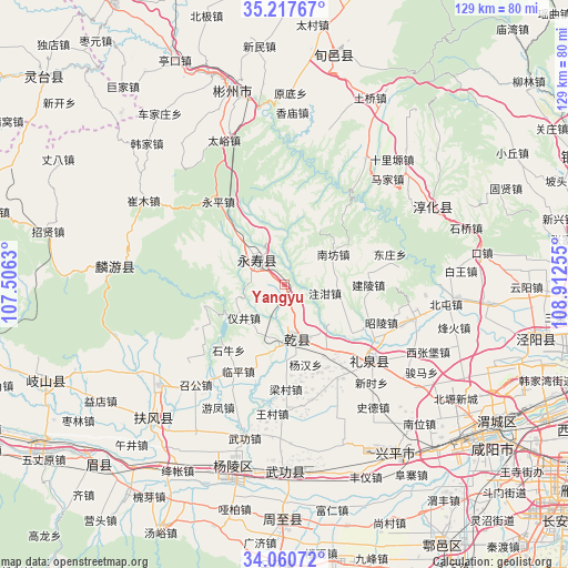
Yangyu GPS coordinates[2]
34° 38' 28.356" North, 108° 12' 33.912" East
| Map corner | latitude | longitude |
|---|---|---|
| Upper-left | 35.21767°, | 107.5063° |
| Center: | 34.64121°, | 108.20942° |
| Lower-right: | 34.06072°, | 108.91255° |
| Map W x H: | 128.6×128.6 km | = 79.9×79.9mi |
| max Lat: | 53.31946° ⇑26.5% North |
| Yangyu: | 34.64121° |
| min Lat: | ⇓73.5% South 18.22056° |
| min Long | Yangyu | max Long |
| 75.07348° | 108.20942° | 134.28917° |
| W 20.2%⇐ | ⇒79.8% E |
Elevation
Elevation of Yangyu is 886 m = 2907 ft, and this is 401.2 m = 1316 ft above average elevation for this country.
| Max E: |
5622 m = 18445 ft | 16.5% |
| Yangyu | 886 m 2907 ft | |
| Avg. | 484.8 m = 1591 ft | |
Min E: |
-3 m = -10 ft | 83.5% |
See also: China elevation on elevation.city.
Geographical zone
Yangyu is located in North temperate zone (between Tropic of Cancer and the Arctic Circle). Distance of this Northern Tropic circle is 1245.8 km =774.1 mi to South.| Distance of | km | miles | from Yangyu |
|---|---|---|---|
| North Pole | 6155.3 | 3824.7 | to North |
| Arctic Circle | 3549.4 | 2205.5 | to North |
| Tropic Cancer | 1245.8 | 774.1 | to South |
| Equator | 3851.7 | 2393.3 | to South |


Nearby cities:
15 places around Yangyu: (largest is in red/bold)
• Dayang
18.4 km =11.4 mi,  149°
149°
• Duma
15.4 km =9.6 mi,  333°
333°
• Fengyang
7.8 km =4.8 mi,  53°
53°
• Ganjing
15.9 km =9.9 mi,  303°
303°
• Guantou
12.5 km =7.8 mi,  278°
278°
• Jianjun
8.5 km =5.3 mi,  311°
311°
• Liangshan
2.7 km =1.7 mi,  214°
214°
• Mafang
16.6 km =10.3 mi,  345°
345°
• Moxi
14.2 km =8.8 mi,  187°
187°
• Nanfang
13.6 km =8.5 mi,  56°
56°
• Shitan
15.4 km =9.6 mi,  118°
118°
• Yanghong
16.6 km =10.3 mi,  144°
144°
• Yijing
12.3 km =7.6 mi,  231°
231°
• Yujiagong
10 km =6.2 mi, 348°
• Zhuganzhen
9.3 km =5.8 mi,  101°
101°
Sources, notices
• [Note1] Compared only with cities in China existing in our database
• [Src1] Map data: © OpenStreetMap contributors (CC-BY-SA)
• [Src2] Other city data from geonames.org with taken over terms of usage.
• [Src3] Geographical zone / Annual Mean Temperature by Robert A. Rohde @ Wikipedia
