Shitan geodata
Shitan (Shaanxi) is a seat of a fourth-order administrative division; located in China in Asia/Shanghai (GMT+8) time zone. In our database, there are 1268 cities with bigger population. Compared to other cities in China, 73.2% of cities are located further ↓South; 79.2% of cities are located further →East and 80.2% of cities have lower elevation than Shitan. Note1


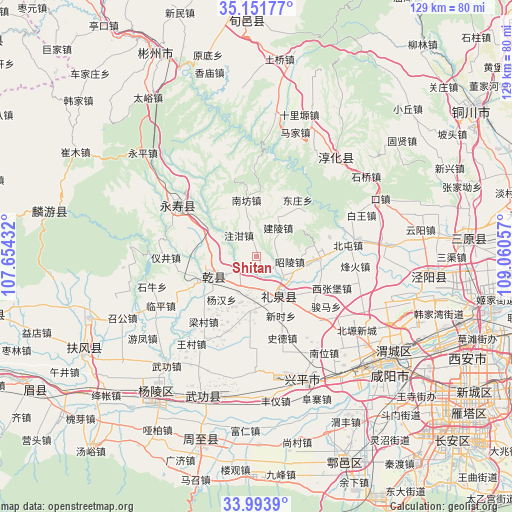
Shitan GPS coordinates[2]
34° 34' 29.46" North, 108° 21' 26.784" East
| Map corner | latitude | longitude |
|---|---|---|
| Upper-left | 35.15177°, | 107.65432° |
| Center: | 34.57485°, | 108.35744° |
| Lower-right: | 33.9939°, | 109.06057° |
| Map W x H: | 128.7×128.7 km | = 80×80mi |
| max Lat: | 53.31946° ⇑26.8% North |
| Shitan: | 34.57485° |
| min Lat: | ⇓73.2% South 18.22056° |
| min Long | Shitan | max Long |
| 75.07348° | 108.35744° | 134.28917° |
| W 20.8%⇐ | ⇒79.2% E |
Elevation
Elevation of Shitan is 703 m = 2306 ft, and this is 218.2 m = 716 ft above average elevation for this country.
| Max E: |
5622 m = 18445 ft | 19.8% |
| Shitan | 703 m 2306 ft | |
| Avg. | 484.8 m = 1591 ft | |
Min E: |
-3 m = -10 ft | 80.2% |
See also: China elevation on elevation.city.
Geographical zone
Shitan is located in North temperate zone (between Tropic of Cancer and the Arctic Circle). Distance of this Northern Tropic circle is 1238.4 km =769.5 mi to South.| Distance of | km | miles | from Shitan |
|---|---|---|---|
| North Pole | 6162.7 | 3829.3 | to North |
| Arctic Circle | 3556.8 | 2210.1 | to North |
| Tropic Cancer | 1238.4 | 769.5 | to South |
| Equator | 3844.4 | 2388.8 | to South |


Nearby cities:
15 places around Shitan: (largest is in red/bold)
• Chigan
16.3 km =10.1 mi,  24°
24°
• Daqiang
14 km =8.7 mi,  187°
187°
• Dayang
9.5 km =5.9 mi,  206°
206°
• Fengyang
14.1 km =8.8 mi,  328°
328°
• Jianling
8.9 km =5.5 mi,  36°
36°
• Liangshan
15.9 km =9.9 mi,  288°
288°
• Lingyuan
8.1 km =5 mi, 185°
• Liquan Chengguanzhen
12.1 km =7.5 mi,  149°
149°
• Moxi
16.8 km =10.4 mi,  246°
246°
• Nanfang
15 km =9.3 mi,  351°
351°
• Yanghong
7.3 km =4.5 mi, 212°
• Yangyu
15.4 km =9.6 mi,  298°
298°
• Zhaoling
8.3 km =5.2 mi,  99°
99°
• Zhaozhen
12.9 km =8 mi, 98°
• Zhuganzhen
7.1 km =4.4 mi,  320°
320°
Sources, notices
• [Note1] Compared only with cities in China existing in our database
• [Src1] Map data: © OpenStreetMap contributors (CC-BY-SA)
• [Src2] Other city data from geonames.org with taken over terms of usage.
• [Src3] Geographical zone / Annual Mean Temperature by Robert A. Rohde @ Wikipedia
