Yanbodu geodata
Yanbodu (Hunan) is a seat of a fourth-order administrative division; located in China in Asia/Shanghai (GMT+8) time zone. In our database, there are 1268 cities with bigger population. Compared to other cities in China, 61.1% of cities are located further ↑North; 67.1% of cities are located further →East and 58.4% of cities have higher elevation than Yanbodu. Note1


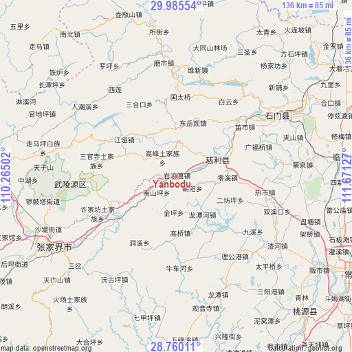
Yanbodu GPS coordinates[2]
29° 22' 28.812" North, 110° 58' 5.304" East
| Map corner | latitude | longitude |
|---|---|---|
| Upper-left | 29.98554°, | 110.26502° |
| Center: | 29.37467°, | 110.96814° |
| Lower-right: | 28.76011°, | 111.67127° |
| Map W x H: | 136.3×136.3 km | = 84.7×84.7mi |
| max Lat: | 53.31946° ⇑61.1% North |
| Yanbodu: | 29.37467° |
| min Lat: | ⇓38.9% South 18.22056° |
| min Long | Yanbodu | max Long |
| 75.07348° | 110.96814° | 134.28917° |
| W 32.9%⇐ | ⇒67.1% E |
Elevation
Elevation of Yanbodu is 109 m = 358 ft, and this is 375.8 m = 1233 ft below average elevation for this country.
| Max E: |
5622 m = 18445 ft | 58.4% |
| Avg. | 484.8 m = 1591 ft | |
| Yanbodu | 109 m = 358 ft | |
Min E: |
-3 m = -10 ft | 41.6% |
See also: China elevation on elevation.city.
Geographical zone
Yanbodu is located in North temperate zone (between Tropic of Cancer and the Arctic Circle). Distance of this Northern Tropic circle is 660.2 km =410.2 mi to South.| Distance of | km | miles | from Yanbodu |
|---|---|---|---|
| North Pole | 6740.9 | 4188.6 | to North |
| Arctic Circle | 4135 | 2569.4 | to North |
| Tropic Cancer | 660.2 | 410.2 | to South |
| Equator | 3266.2 | 2029.5 | to South |


Nearby cities:
15 places around Yanbodu: (largest is in red/bold)
• Chaoyang
7.5 km =4.7 mi,  125°
125°
• Cili
15.7 km =9.8 mi,  69°
69°
• Dongyueguan
21.6 km =13.4 mi,  17°
17°
• Ganyan
21.2 km =13.2 mi,  239°
239°
• Gaofeng
8.5 km =5.3 mi,  324°
324°
• Gaoqiao
22.3 km =13.9 mi,  175°
175°
• Jinglongqiao
14.8 km =9.2 mi,  122°
122°
• Jinping
14.2 km =8.8 mi, 183°
• Lingxi
20 km =12.4 mi,  91°
91°
• Longtanhe
18 km =11.2 mi,  144°
144°
• Nanshanping
9.6 km =6 mi,  228°
228°
• Shanmuqiao
18.5 km =11.5 mi,  349°
349°
• Tongjinpu
18.2 km =11.3 mi,  359°
359°
• Xiangshi
20.3 km =12.6 mi, 321°
• Yichongqiao
11.4 km =7.1 mi,  245°
245°
Sources, notices
• [Note1] Compared only with cities in China existing in our database
• [Src1] Map data: © OpenStreetMap contributors (CC-BY-SA)
• [Src2] Other city data from geonames.org with taken over terms of usage.
• [Src3] Geographical zone / Annual Mean Temperature by Robert A. Rohde @ Wikipedia
