Xiongzhou geodata
Xiongzhou (Guangdong) is a seat of a third-order administrative division; located in China in Asia/Shanghai (GMT+8) time zone. With population of 79,050 people, there are 540 cities with bigger population in this country. Compared to other cities in China, 85.9% of cities are located further ↑North; 50.3% of cities are located further ←West and 56.7% of cities have higher elevation than Xiongzhou. Note1


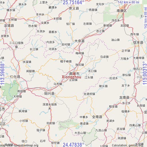
Xiongzhou GPS coordinates[2]
25° 7' 0.012" North, 114° 18' 0" East
| Map corner | latitude | longitude |
|---|---|---|
| Upper-left | 25.75164°, | 113.59688° |
| Center: | 25.11667°, | 114.3° |
| Lower-right: | 24.47838°, | 115.00313° |
| Map W x H: | 141.6×141.6 km | = 88×88mi |
| max Lat: | 53.31946° ⇑85.9% North |
| Xiongzhou: | 25.11667° |
| min Lat: | ⇓14.1% South 18.22056° |
| min Long | Xiongzhou | max Long |
| 75.07348° | 114.3° | 134.28917° |
| W 50.3%⇐ | ⇒49.7% E |
Elevation
Elevation of Xiongzhou is 119 m = 390 ft, and this is 365.8 m = 1200 ft below average elevation for this country.
| Max E: |
5622 m = 18445 ft | 56.7% |
| Avg. | 484.8 m = 1591 ft | |
| Xiongzhou | 119 m = 390 ft | |
Min E: |
-3 m = -10 ft | 43.3% |
See also: Xiongzhou elevation on elevation.city.
Geographical zone
Xiongzhou is located in North temperate zone (between Tropic of Cancer and the Arctic Circle). Distance of this Northern Tropic circle is 186.8 km =116.1 mi to South.| Distance of | km | miles | from Xiongzhou |
|---|---|---|---|
| North Pole | 7214.4 | 4482.8 | to North |
| Arctic Circle | 4608.5 | 2863.6 | to North |
| Tropic Cancer | 186.8 | 116.1 | to South |
| Equator | 2792.7 | 1735.3 | to South |


Nearby cities:
15 places around Xiongzhou: (largest is in red/bold)
• Cangshi
9.8 km =6.1 mi,  279°
279°
• Chengjiang
22.4 km =13.9 mi,  170°
170°
• Dengfang
21.7 km =13.5 mi,  41°
41°
• Gushi
8.5 km =5.3 mi,  217°
217°
• Huangkeng
23.9 km =14.9 mi,  59°
59°
• Hukou
11.9 km =7.4 mi, 58°
• Jiangtou
15 km =9.3 mi,  102°
102°
• Lanhe
20.7 km =12.9 mi,  309°
309°
• Maozifeng
14.2 km =8.8 mi,  328°
328°
• Mashi
18.1 km =11.2 mi,  237°
237°
• Meiling
20.6 km =12.8 mi,  16°
16°
• Quan’an
4.4 km =2.7 mi,  289°
289°
• Shuikou
18.3 km =11.4 mi,  81°
81°
• Zhuji
9.7 km =6 mi, 38°
• Zhutian
5.7 km =3.5 mi,  184°
184°
Sources, notices
• [Note1] Compared only with cities in China existing in our database
• [Src1] Map data: © OpenStreetMap contributors (CC-BY-SA)
• [Src2] Other city data from geonames.org with taken over terms of usage.
• [Src3] Geographical zone / Annual Mean Temperature by Robert A. Rohde @ Wikipedia
