Xinjie geodata
Xinjie (Jiangxi) is a seat of a fourth-order administrative division; located in China in Asia/Shanghai (GMT+8) time zone. In our database, there are 1268 cities with bigger population. Compared to other cities in China, 72.1% of cities are located further ↑North; 56.4% of cities are located further ←West and 70% of cities have higher elevation than Xinjie. Note1


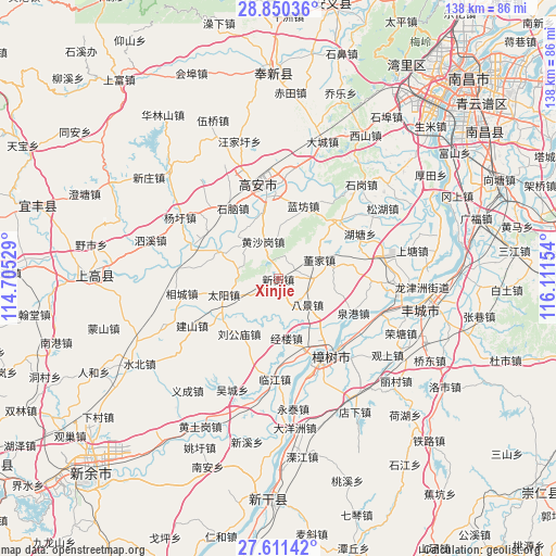
Xinjie GPS coordinates[2]
28° 13' 57.684" North, 115° 24' 30.276" East
| Map corner | latitude | longitude |
|---|---|---|
| Upper-left | 28.85036°, | 114.70529° |
| Center: | 28.23269°, | 115.40841° |
| Lower-right: | 27.61142°, | 116.11154° |
| Map W x H: | 137.8×137.8 km | = 85.6×85.6mi |
| max Lat: | 53.31946° ⇑72.1% North |
| Xinjie: | 28.23269° |
| min Lat: | ⇓27.9% South 18.22056° |
| min Long | Xinjie | max Long |
| 75.07348° | 115.40841° | 134.28917° |
| W 56.4%⇐ | ⇒43.6% E |
Elevation
Elevation of Xinjie is 52 m = 171 ft, and this is 432.8 m = 1420 ft below average elevation for this country.
| Max E: |
5622 m = 18445 ft | 70% |
| Avg. | 484.8 m = 1591 ft | |
| Xinjie | 52 m = 171 ft | |
Min E: |
-3 m = -10 ft | 30% |
See also: China elevation on elevation.city.
Geographical zone
Xinjie is located in North temperate zone (between Tropic of Cancer and the Arctic Circle). Distance of this Northern Tropic circle is 533.3 km =331.4 mi to South.| Distance of | km | miles | from Xinjie |
|---|---|---|---|
| North Pole | 6867.9 | 4267.5 | to North |
| Arctic Circle | 4262 | 2648.3 | to North |
| Tropic Cancer | 533.3 | 331.4 | to South |
| Equator | 3139.2 | 1950.6 | to South |


Nearby cities:
15 places around Xinjie: (largest is in red/bold)
• Bajing
9.6 km =6 mi,  130°
130°
• Dongjia
11 km =6.8 mi,  65°
65°
• Ducheng
8.1 km =5 mi,  89°
89°
• Heling
13.4 km =8.3 mi,  1°
1°
• Huangcheng
20.6 km =12.8 mi,  46°
46°
• Huangshagang
10.1 km =6.3 mi,  336°
336°
• Huibu
16.8 km =10.4 mi,  294°
294°
• Jinglou
14.8 km =9.2 mi,  173°
173°
• Lanfangzhen
19 km =11.8 mi,  17°
17°
• Liugongmiao
16.9 km =10.5 mi,  216°
216°
• Quangang
20.3 km =12.6 mi,  114°
114°
• Shanghu
14.9 km =9.3 mi,  327°
327°
• Taiyang
14.3 km =8.9 mi,  253°
253°
• Xinjiezhen
0 km =0 mi,  180°
180°
• Zhangjiashan
17.8 km =11.1 mi,  157°
157°
Sources, notices
• [Note1] Compared only with cities in China existing in our database
• [Src1] Map data: © OpenStreetMap contributors (CC-BY-SA)
• [Src2] Other city data from geonames.org with taken over terms of usage.
• [Src3] Geographical zone / Annual Mean Temperature by Robert A. Rohde @ Wikipedia
