Xiji geodata
Xiji (Beijing) is a seat of a fourth-order administrative division; located in China in Asia/Shanghai (GMT+8) time zone. In our database, there are 1268 cities with bigger population. Compared to other cities in China, 85.7% of cities are located further ↓South; 65.4% of cities are located further ←West and 82.1% of cities have higher elevation than Xiji. Note1


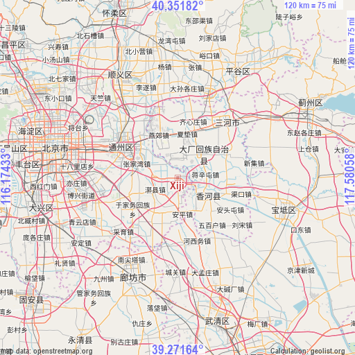
Xiji GPS coordinates[2]
39° 48' 49.86" North, 116° 52' 38.82" East
| Map corner | latitude | longitude |
|---|---|---|
| Upper-left | 40.35182°, | 116.17433° |
| Center: | 39.81385°, | 116.87745° |
| Lower-right: | 39.27164°, | 117.58058° |
| Map W x H: | 120.1×120.1 km | = 74.6×74.6mi |
| max Lat: | 53.31946° ⇑14.3% North |
| Xiji: | 39.81385° |
| min Lat: | ⇓85.7% South 18.22056° |
| min Long | Xiji | max Long |
| 75.07348° | 116.87745° | 134.28917° |
| W 65.4%⇐ | ⇒34.6% E |
Elevation
Elevation of Xiji is 22 m = 72 ft, and this is 462.8 m = 1518 ft below average elevation for this country.
| Max E: |
5622 m = 18445 ft | 82.1% |
| Avg. | 484.8 m = 1591 ft | |
| Xiji | 22 m = 72 ft | |
Min E: |
-3 m = -10 ft | 17.9% |
See also: China elevation on elevation.city.
Geographical zone
Xiji is located in North temperate zone (between Tropic of Cancer and the Arctic Circle). Distance of this Northern Tropic circle is 1821 km =1131.5 mi to South.| Distance of | km | miles | from Xiji |
|---|---|---|---|
| North Pole | 5580.2 | 3467.4 | to North |
| Arctic Circle | 2974.3 | 1848.1 | to North |
| Tropic Cancer | 1821 | 1131.5 | to South |
| Equator | 4426.9 | 2750.7 | to South |


Nearby cities:
15 places around Xiji: (largest is in red/bold)
• Beiyuan
22.1 km =13.7 mi,  296°
296°
• Gantang
7.5 km =4.7 mi,  308°
308°
• Goutou
27.5 km =17.1 mi,  92°
92°
• Huoxian
9.1 km =5.7 mi,  241°
241°
• Liyuan
20 km =12.4 mi,  288°
288°
• Panggezhuang
24.7 km =15.3 mi, 92°
• Sangzi
26 km =16.2 mi,  66°
66°
• Songzhuang
19.7 km =12.2 mi,  318°
318°
• Taihu
20.4 km =12.7 mi,  275°
275°
• Tongzhou
21 km =13 mi, 298°
• Xiawuqi
26.9 km =16.7 mi,  145°
145°
• Yongledian
14.5 km =9 mi,  216°
216°
• Yujiawu
18.1 km =11.2 mi, 235°
• Zhangjiawan
16 km =9.9 mi, 288°
• Zhaogezhuang
27.4 km =17 mi,  96°
96°
Sources, notices
• [Note1] Compared only with cities in China existing in our database
• [Src1] Map data: © OpenStreetMap contributors (CC-BY-SA)
• [Src2] Other city data from geonames.org with taken over terms of usage.
• [Src3] Geographical zone / Annual Mean Temperature by Robert A. Rohde @ Wikipedia
