Xihuaiba geodata
Xihuaiba (Shaanxi) is a seat of a fourth-order administrative division; located in China in Asia/Shanghai (GMT+8) time zone. In our database, there are 1268 cities with bigger population. Compared to other cities in China, 68.1% of cities are located further ↓South; 87.2% of cities are located further →East and 85.4% of cities have lower elevation than Xihuaiba. Note1


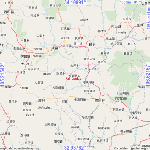
Xihuaiba GPS coordinates[2]
33° 31' 32.7" North, 105° 55' 6.744" East
| Map corner | latitude | longitude |
|---|---|---|
| Upper-left | 34.10991°, | 105.21542° |
| Center: | 33.52575°, | 105.91854° |
| Lower-right: | 32.93762°, | 106.62167° |
| Map W x H: | 130.3×130.3 km | = 81×81mi |
| max Lat: | 53.31946° ⇑31.9% North |
| Xihuaiba: | 33.52575° |
| min Lat: | ⇓68.1% South 18.22056° |
| min Long | Xihuaiba | max Long |
| 75.07348° | 105.91854° | 134.28917° |
| W 12.8%⇐ | ⇒87.2% E |
Elevation
Elevation of Xihuaiba is 1003 m = 3291 ft, and this is 518.2 m = 1700 ft above average elevation for this country.
| Max E: |
5622 m = 18445 ft | 14.6% |
| Xihuaiba | 1003 m 3291 ft | |
| Avg. | 484.8 m = 1591 ft | |
Min E: |
-3 m = -10 ft | 85.4% |
See also: China elevation on elevation.city.
Geographical zone
Xihuaiba is located in North temperate zone (between Tropic of Cancer and the Arctic Circle). Distance of this Northern Tropic circle is 1121.8 km =697.1 mi to South.| Distance of | km | miles | from Xihuaiba |
|---|---|---|---|
| North Pole | 6279.3 | 3901.8 | to North |
| Arctic Circle | 3673.5 | 2282.6 | to North |
| Tropic Cancer | 1121.8 | 697.1 | to South |
| Equator | 3727.7 | 2316.3 | to South |


Nearby cities:
15 places around Xihuaiba: (largest is in red/bold)
• Baishuijiang
17.2 km =10.7 mi,  70°
70°
• Chanba
16.1 km =10 mi,  293°
293°
• Chanhe
24.3 km =15.1 mi,  272°
272°
• Dahedian
18.7 km =11.6 mi,  40°
40°
• Dananyu
18.2 km =11.3 mi,  234°
234°
• Daping
23 km =14.3 mi,  307°
307°
• Guozhen
23.6 km =14.7 mi,  201°
201°
• Hongchuan
25.1 km =15.6 mi,  354°
354°
• Jinjiahe
21 km =13 mi,  167°
167°
• Matiwan
13.2 km =8.2 mi,  113°
113°
• Miba
12.8 km =8 mi,  278°
278°
• Nankang
15.1 km =9.4 mi, 348°
• Songping
8.6 km =5.3 mi,  355°
355°
• Xujiaping
18.6 km =11.6 mi,  136°
136°
• Yuntai
25.1 km =15.6 mi,  249°
249°
Sources, notices
• [Note1] Compared only with cities in China existing in our database
• [Src1] Map data: © OpenStreetMap contributors (CC-BY-SA)
• [Src2] Other city data from geonames.org with taken over terms of usage.
• [Src3] Geographical zone / Annual Mean Temperature by Robert A. Rohde @ Wikipedia
