Chanba geodata
Chanba (Gansu) is a seat of a fourth-order administrative division; located in China in Asia/Shanghai (GMT+8) time zone. In our database, there are 1268 cities with bigger population. Compared to other cities in China, 68.3% of cities are located further ↓South; 87.6% of cities are located further →East and 82.9% of cities have lower elevation than Chanba. Note1


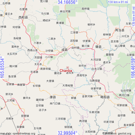
Chanba GPS coordinates[2]
33° 34' 58.044" North, 105° 45' 30.456" East
| Map corner | latitude | longitude |
|---|---|---|
| Upper-left | 34.16656°, | 105.05534° |
| Center: | 33.58279°, | 105.75846° |
| Lower-right: | 32.99504°, | 106.46159° |
| Map W x H: | 130.3×130.3 km | = 81×81mi |
| max Lat: | 53.31946° ⇑31.7% North |
| Chanba: | 33.58279° |
| min Lat: | ⇓68.3% South 18.22056° |
| min Long | Chanba | max Long |
| 75.07348° | 105.75846° | 134.28917° |
| W 12.4%⇐ | ⇒87.6% E |
Elevation
Elevation of Chanba is 846 m = 2776 ft, and this is 361.2 m = 1185 ft above average elevation for this country.
| Max E: |
5622 m = 18445 ft | 17.1% |
| Chanba | 846 m 2776 ft | |
| Avg. | 484.8 m = 1591 ft | |
Min E: |
-3 m = -10 ft | 82.9% |
See also: China elevation on elevation.city.
Geographical zone
Chanba is located in North temperate zone (between Tropic of Cancer and the Arctic Circle). Distance of this Northern Tropic circle is 1128.1 km =701 mi to South.| Distance of | km | miles | from Chanba |
|---|---|---|---|
| North Pole | 6273 | 3897.9 | to North |
| Arctic Circle | 3667.1 | 2278.6 | to North |
| Tropic Cancer | 1128.1 | 701 | to South |
| Equator | 3734.1 | 2320.3 | to South |


Nearby cities:
15 places around Chanba: (largest is in red/bold)
• Chanhe
10.7 km =6.6 mi,  241°
241°
• Chengxian Chengguanzhen
18.5 km =11.5 mi,  352°
352°
• Dananyu
16.9 km =10.5 mi,  180°
180°
• Daping
8.3 km =5.2 mi,  334°
334°
• Huangchen
14.5 km =9 mi,  270°
270°
• Huaya
12.8 km =8 mi,  310°
310°
• Lishan
18 km =11.2 mi,  258°
258°
• Miba
5 km =3.1 mi,  154°
154°
• Nankang
14.4 km =8.9 mi,  54°
54°
• Paosha
17.4 km =10.8 mi, 333°
• Sitai
17.4 km =10.8 mi,  232°
232°
• Songping
14.3 km =8.9 mi,  81°
81°
• Xihuaiba
16.1 km =10 mi,  113°
113°
• Yuntai
17.4 km =10.8 mi,  209°
209°
• Zhiqi
18.5 km =11.5 mi,  355°
355°
Sources, notices
• [Note1] Compared only with cities in China existing in our database
• [Src1] Map data: © OpenStreetMap contributors (CC-BY-SA)
• [Src2] Other city data from geonames.org with taken over terms of usage.
• [Src3] Geographical zone / Annual Mean Temperature by Robert A. Rohde @ Wikipedia
