Wacheng geodata
Wacheng (Henan) is a seat of a third-order administrative division; located in China in Asia/Shanghai (GMT+8) time zone. With population of 66,848 people, there are 642 cities with bigger population in this country. Compared to other cities in China, 69.2% of cities are located further ↓South; 51.7% of cities are located further ←West and 68.9% of cities have higher elevation than Wacheng. Note1


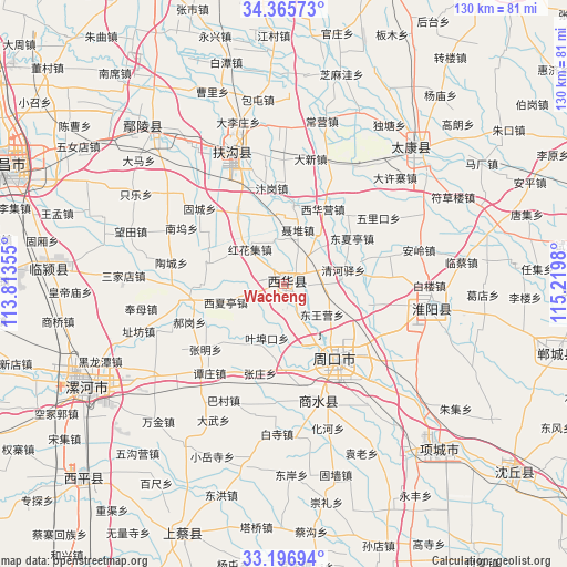
Wacheng GPS coordinates[2]
33° 46' 59.988" North, 114° 31' 0.012" East
| Map corner | latitude | longitude |
|---|---|---|
| Upper-left | 34.36573°, | 113.81355° |
| Center: | 33.78333°, | 114.51667° |
| Lower-right: | 33.19694°, | 115.2198° |
| Map W x H: | 130×130 km | = 80.8×80.8mi |
| max Lat: | 53.31946° ⇑30.8% North |
| Wacheng: | 33.78333° |
| min Lat: | ⇓69.2% South 18.22056° |
| min Long | Wacheng | max Long |
| 75.07348° | 114.51667° | 134.28917° |
| W 51.7%⇐ | ⇒48.3% E |
Elevation
Elevation of Wacheng is 56 m = 184 ft, and this is 428.8 m = 1407 ft below average elevation for this country.
| Max E: |
5622 m = 18445 ft | 68.9% |
| Avg. | 484.8 m = 1591 ft | |
| Wacheng | 56 m = 184 ft | |
Min E: |
-3 m = -10 ft | 31.1% |
See also: Wacheng elevation on elevation.city.
Geographical zone
Wacheng is located in North temperate zone (between Tropic of Cancer and the Arctic Circle). Distance of this Northern Tropic circle is 1150.4 km =714.8 mi to South.| Distance of | km | miles | from Wacheng |
|---|---|---|---|
| North Pole | 6250.7 | 3884 | to North |
| Arctic Circle | 3644.8 | 2264.8 | to North |
| Tropic Cancer | 1150.4 | 714.8 | to South |
| Equator | 3756.4 | 2334.1 | to South |


Nearby cities:
15 places around Wacheng: (largest is in red/bold)
• Anling
48.3 km =30 mi,  318°
318°
• Dizhuang
48 km =29.8 mi,  239°
239°
• Fugou Chengguanzhen
33.8 km =21 mi,  338°
338°
• Ganhechen
52.3 km =32.5 mi, 241°
• Huaiyang Chengguanzhen
34.3 km =21.3 mi,  99°
99°
• Huangdimiao
49.1 km =30.5 mi,  267°
267°
• Huayuan
48.1 km =29.9 mi,  136°
136°
• Juling
52.2 km =32.4 mi,  279°
279°
• Luohe
50.2 km =31.2 mi, 240°
• Shangqiao
52.5 km =32.6 mi,  260°
260°
• Taikang Chengguanzhen
45.1 km =28 mi,  45°
45°
• Xincheng
27.9 km =17.3 mi,  164°
164°
• Yancheng Chengguanzhen
53.8 km =33.4 mi,  245°
245°
• Zhangpan
53.9 km =33.5 mi,  295°
295°
• Zhoukou
19.9 km =12.4 mi,  147°
147°
Sources, notices
• [Note1] Compared only with cities in China existing in our database
• [Src1] Map data: © OpenStreetMap contributors (CC-BY-SA)
• [Src2] Other city data from geonames.org with taken over terms of usage.
• [Src3] Geographical zone / Annual Mean Temperature by Robert A. Rohde @ Wikipedia
