Xiepu geodata
Xiepu (Zhejiang) is a seat of a fourth-order administrative division; located in China in Asia/Shanghai (GMT+8) time zone. In our database, there are 1268 cities with bigger population. Compared to other cities in China, 53.7% of cities are located further ↑North; 90.3% of cities are located further ←West and 98.3% of cities have higher elevation than Xiepu. Note1


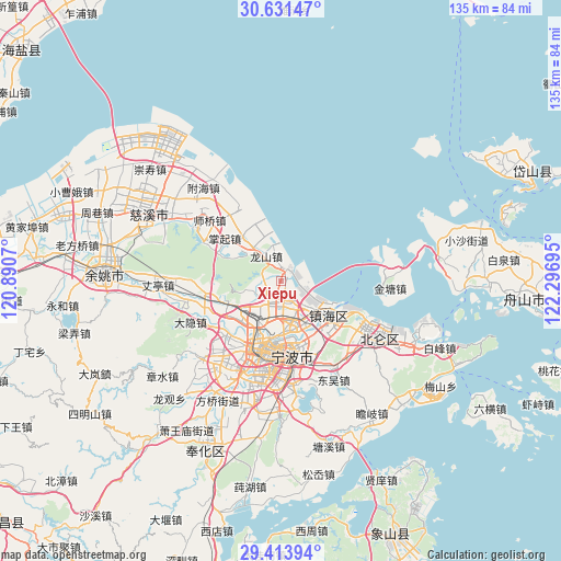
Xiepu GPS coordinates[2]
30° 1' 28.452" North, 121° 35' 37.752" East
| Map corner | latitude | longitude |
|---|---|---|
| Upper-left | 30.63147°, | 120.8907° |
| Center: | 30.02457°, | 121.59382° |
| Lower-right: | 29.41394°, | 122.29695° |
| Map W x H: | 135.4×135.4 km | = 84.1×84.1mi |
| max Lat: | 53.31946° ⇑53.7% North |
| Xiepu: | 30.02457° |
| min Lat: | ⇓46.3% South 18.22056° |
| min Long | Xiepu | max Long |
| 75.07348° | 121.59382° | 134.28917° |
| W 90.3%⇐ | ⇒9.7% E |
Elevation
Elevation of Xiepu is 4 m = 13 ft, and this is 480.8 m = 1577 ft below average elevation for this country.
| Max E: |
5622 m = 18445 ft | 98.3% |
| Avg. | 484.8 m = 1591 ft | |
| Xiepu | 4 m = 13 ft | |
Min E: |
-3 m = -10 ft | 1.7% |
See also: China elevation on elevation.city.
Geographical zone
Xiepu is located in North temperate zone (between Tropic of Cancer and the Arctic Circle). Distance of this Northern Tropic circle is 732.5 km =455.2 mi to South.| Distance of | km | miles | from Xiepu |
|---|---|---|---|
| North Pole | 6668.6 | 4143.7 | to North |
| Arctic Circle | 4062.8 | 2524.5 | to North |
| Tropic Cancer | 732.5 | 455.2 | to South |
| Equator | 3338.4 | 2074.4 | to South |


Nearby cities:
15 places around Xiepu: (largest is in red/bold)
• Cicheng
15.5 km =9.6 mi,  252°
252°
• Dongjiao
16.6 km =10.3 mi,  182°
182°
• Fuming
16.9 km =10.5 mi, 177°
• Hongtang
11.7 km =7.3 mi,  226°
226°
• Jiulonghu
3.8 km =2.4 mi,  302°
302°
• Longshan
7.2 km =4.5 mi,  326°
326°
• Luotuo
4.5 km =2.8 mi, 184°
• Ningbo
16.8 km =10.4 mi,  194°
194°
• Sanbei
12.1 km =7.5 mi,  310°
310°
• Xiaogang
16.6 km =10.3 mi,  119°
119°
• Yangjia
15.1 km =9.4 mi, 306°
• Yongjiang
13.5 km =8.4 mi, 186°
• Zhaobaoshan
10.9 km =6.8 mi, 124°
• Zhuangqiao
11.4 km =7.1 mi,  202°
202°
• Zhuangshi
10.3 km =6.4 mi,  171°
171°
Sources, notices
• [Note1] Compared only with cities in China existing in our database
• [Src1] Map data: © OpenStreetMap contributors (CC-BY-SA)
• [Src2] Other city data from geonames.org with taken over terms of usage.
• [Src3] Geographical zone / Annual Mean Temperature by Robert A. Rohde @ Wikipedia
