Xiaruyue geodata
Xiaruyue (Shanxi) is a seat of a fourth-order administrative division; located in China in Asia/Shanghai (GMT+8) time zone. In our database, there are 1268 cities with bigger population. Compared to other cities in China, 83.8% of cities are located further ↓South; 55.3% of cities are located further →East and 85.1% of cities have lower elevation than Xiaruyue. Note1


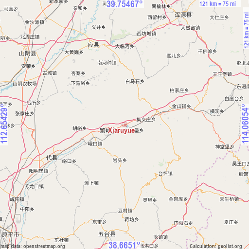
Xiaruyue GPS coordinates[2]
39° 12' 43.2" North, 113° 21' 26.676" East
| Map corner | latitude | longitude |
|---|---|---|
| Upper-left | 39.75467°, | 112.65429° |
| Center: | 39.212°, | 113.35741° |
| Lower-right: | 38.6651°, | 114.06054° |
| Map W x H: | 121.1×121.1 km | = 75.2×75.2mi |
| max Lat: | 53.31946° ⇑16.2% North |
| Xiaruyue: | 39.212° |
| min Lat: | ⇓83.8% South 18.22056° |
| min Long | Xiaruyue | max Long |
| 75.07348° | 113.35741° | 134.28917° |
| W 44.7%⇐ | ⇒55.3% E |
Elevation
Elevation of Xiaruyue is 989 m = 3245 ft, and this is 504.2 m = 1654 ft above average elevation for this country.
| Max E: |
5622 m = 18445 ft | 14.9% |
| Xiaruyue | 989 m 3245 ft | |
| Avg. | 484.8 m = 1591 ft | |
Min E: |
-3 m = -10 ft | 85.1% |
See also: China elevation on elevation.city.
Geographical zone
Xiaruyue is located in North temperate zone (between Tropic of Cancer and the Arctic Circle). Distance of this Northern Tropic circle is 1754 km =1089.9 mi to South.| Distance of | km | miles | from Xiaruyue |
|---|---|---|---|
| North Pole | 5647.1 | 3508.9 | to North |
| Arctic Circle | 3041.2 | 1889.7 | to North |
| Tropic Cancer | 1754 | 1089.9 | to South |
| Equator | 4360 | 2709.2 | to South |


Nearby cities:
15 places around Xiaruyue: (largest is in red/bold)
• Baijiazhuang
31.5 km =19.6 mi,  57°
57°
• Ekou
16.9 km =10.5 mi,  237°
237°
• Fanshi
8.4 km =5.2 mi,  253°
253°
• Guangyubao
5.3 km =3.3 mi,  118°
118°
• Huyu
22 km =13.7 mi,  266°
266°
• Jinshanpu
29.2 km =18.1 mi,  71°
71°
• Jiyizhuang
10.8 km =6.7 mi,  75°
75°
• Nanquan
27.9 km =17.3 mi,  326°
326°
• Nieying
21.6 km =13.4 mi, 243°
• Shahe
17.7 km =11 mi, 68°
• Xiamayu
29.6 km =18.4 mi,  313°
313°
• Xicun
21.9 km =13.6 mi, 252°
• Xingyuan
9 km =5.6 mi, 238°
• Yanglinjie
30.3 km =18.8 mi,  138°
138°
• Yantou
17 km =10.6 mi,  188°
188°
Sources, notices
• [Note1] Compared only with cities in China existing in our database
• [Src1] Map data: © OpenStreetMap contributors (CC-BY-SA)
• [Src2] Other city data from geonames.org with taken over terms of usage.
• [Src3] Geographical zone / Annual Mean Temperature by Robert A. Rohde @ Wikipedia
