Xiacheng geodata
Xiacheng (Gansu) is a seat of a fourth-order administrative division; located in China in Asia/Shanghai (GMT+8) time zone. In our database, there are 1268 cities with bigger population. Compared to other cities in China, 75% of cities are located further ↓South; 90.6% of cities are located further →East and 94.8% of cities have lower elevation than Xiacheng. Note1


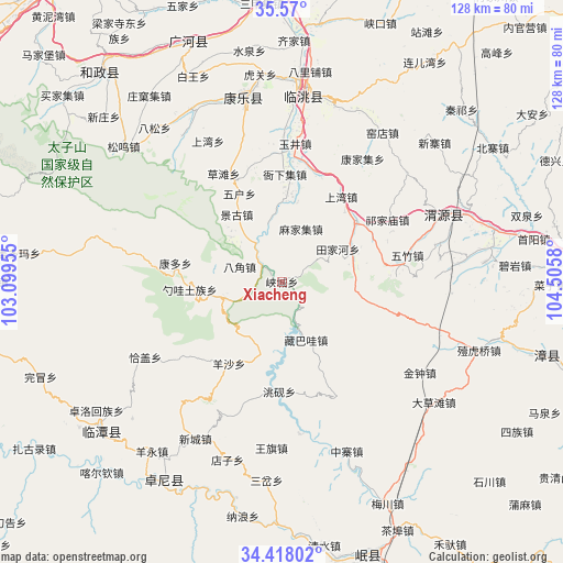
Xiacheng GPS coordinates[2]
34° 59' 45.744" North, 103° 48' 9.612" East
| Map corner | latitude | longitude |
|---|---|---|
| Upper-left | 35.57°, | 103.09955° |
| Center: | 34.99604°, | 103.80267° |
| Lower-right: | 34.41802°, | 104.5058° |
| Map W x H: | 128.1×128.1 km | = 79.6×79.6mi |
| max Lat: | 53.31946° ⇑25% North |
| Xiacheng: | 34.99604° |
| min Lat: | ⇓75% South 18.22056° |
| min Long | Xiacheng | max Long |
| 75.07348° | 103.80267° | 134.28917° |
| W 9.4%⇐ | ⇒90.6% E |
Elevation
Elevation of Xiacheng is 2056 m = 6745 ft, and this is 1571.2 m = 5155 ft above average elevation for this country.
| Max E: |
5622 m = 18445 ft | 5.2% |
| Xiacheng | 2056 m 6745 ft | |
| Avg. | 484.8 m = 1591 ft | |
Min E: |
-3 m = -10 ft | 94.8% |
See also: China elevation on elevation.city.
Geographical zone
Xiacheng is located in North temperate zone (between Tropic of Cancer and the Arctic Circle). Distance of this Northern Tropic circle is 1285.3 km =798.6 mi to South.| Distance of | km | miles | from Xiacheng |
|---|---|---|---|
| North Pole | 6115.9 | 3800.2 | to North |
| Arctic Circle | 3510 | 2181 | to North |
| Tropic Cancer | 1285.3 | 798.6 | to South |
| Equator | 3891.2 | 2417.9 | to South |


Nearby cities:
15 places around Xiacheng: (largest is in red/bold)
• Bailin
28.8 km =17.9 mi,  154°
154°
• Bajiao
10.3 km =6.4 mi,  290°
290°
• Baozi
36.8 km =22.9 mi,  168°
168°
• Chenqi
34.6 km =21.5 mi, 173°
• Kangduo
25.7 km =16 mi,  279°
279°
• Lianlu
5.6 km =3.5 mi, 291°
• Qiagai
35.5 km =22.1 mi,  241°
241°
• Shaowa
22 km =13.7 mi,  264°
264°
• Shimen
30.3 km =18.8 mi,  197°
197°
• Tianjiahe
14.6 km =9.1 mi,  59°
59°
• Weixin
37.1 km =23.1 mi, 170°
• Yangsha
22 km =13.7 mi,  213°
213°
• Yangzhuang
22.9 km =14.2 mi,  69°
69°
• Yeliguan
13.4 km =8.3 mi,  254°
254°
• Zangbawa
14.3 km =8.9 mi,  157°
157°
Sources, notices
• [Note1] Compared only with cities in China existing in our database
• [Src1] Map data: © OpenStreetMap contributors (CC-BY-SA)
• [Src2] Other city data from geonames.org with taken over terms of usage.
• [Src3] Geographical zone / Annual Mean Temperature by Robert A. Rohde @ Wikipedia
