Zangbawa geodata
Zangbawa (Gansu) is a seat of a fourth-order administrative division; located in China in Asia/Shanghai (GMT+8) time zone. In our database, there are 1268 cities with bigger population. Compared to other cities in China, 74.6% of cities are located further ↓South; 90.5% of cities are located further →East and 95.3% of cities have lower elevation than Zangbawa. Note1


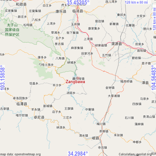
Zangbawa GPS coordinates[2]
34° 52' 38.1" North, 103° 51' 42.12" East
| Map corner | latitude | longitude |
|---|---|---|
| Upper-left | 35.45205°, | 103.15858° |
| Center: | 34.87725°, | 103.8617° |
| Lower-right: | 34.2984°, | 104.56483° |
| Map W x H: | 128.3×128.3 km | = 79.7×79.7mi |
| max Lat: | 53.31946° ⇑25.4% North |
| Zangbawa: | 34.87725° |
| min Lat: | ⇓74.6% South 18.22056° |
| min Long | Zangbawa | max Long |
| 75.07348° | 103.8617° | 134.28917° |
| W 9.5%⇐ | ⇒90.5% E |
Elevation
Elevation of Zangbawa is 2216 m = 7270 ft, and this is 1731.2 m = 5680 ft above average elevation for this country.
| Max E: |
5622 m = 18445 ft | 4.7% |
| Zangbawa | 2216 m 7270 ft | |
| Avg. | 484.8 m = 1591 ft | |
Min E: |
-3 m = -10 ft | 95.3% |
See also: China elevation on elevation.city.
Geographical zone
Zangbawa is located in North temperate zone (between Tropic of Cancer and the Arctic Circle). Distance of this Northern Tropic circle is 1272.1 km =790.4 mi to South.| Distance of | km | miles | from Zangbawa |
|---|---|---|---|
| North Pole | 6129.1 | 3808.4 | to North |
| Arctic Circle | 3523.2 | 2189.2 | to North |
| Tropic Cancer | 1272.1 | 790.4 | to South |
| Equator | 3878 | 2409.7 | to South |


Nearby cities:
15 places around Zangbawa: (largest is in red/bold)
• Bailin
14.6 km =9.1 mi,  150°
150°
• Bajiao
22.5 km =14 mi,  318°
318°
• Baozi
23 km =14.3 mi,  175°
175°
• Chenqi
21.3 km =13.2 mi, 184°
• Lianlu
18.6 km =11.6 mi,  325°
325°
• Longyuan
26 km =16.2 mi,  197°
197°
• Shaowa
29.5 km =18.3 mi,  292°
292°
• Shimen
21.5 km =13.4 mi,  222°
222°
• Tianjiahe
21.8 km =13.5 mi,  19°
19°
• Weixin
23.4 km =14.5 mi, 178°
• Xiacheng
14.3 km =8.9 mi,  337°
337°
• Yangsha
18.4 km =11.4 mi,  253°
253°
• Yangzhuang
26.6 km =16.5 mi,  37°
37°
• Yeliguan
20.7 km =12.9 mi,  297°
297°
• Zhongzhai
27.1 km =16.8 mi,  159°
159°
Sources, notices
• [Note1] Compared only with cities in China existing in our database
• [Src1] Map data: © OpenStreetMap contributors (CC-BY-SA)
• [Src2] Other city data from geonames.org with taken over terms of usage.
• [Src3] Geographical zone / Annual Mean Temperature by Robert A. Rohde @ Wikipedia
