Tianjiahe geodata
Tianjiahe (Gansu) is a seat of a fourth-order administrative division; located in China in Asia/Shanghai (GMT+8) time zone. In our database, there are 1268 cities with bigger population. Compared to other cities in China, 75.2% of cities are located further ↓South; 90.4% of cities are located further →East and 95.6% of cities have lower elevation than Tianjiahe. Note1


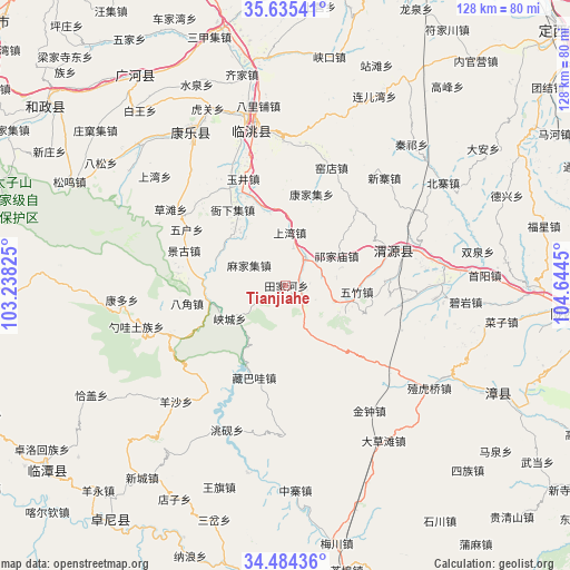
Tianjiahe GPS coordinates[2]
35° 3' 42.876" North, 103° 56' 28.932" East
| Map corner | latitude | longitude |
|---|---|---|
| Upper-left | 35.63541°, | 103.23825° |
| Center: | 35.06191°, | 103.94137° |
| Lower-right: | 34.48436°, | 104.6445° |
| Map W x H: | 128×128 km | = 79.5×79.5mi |
| max Lat: | 53.31946° ⇑24.8% North |
| Tianjiahe: | 35.06191° |
| min Lat: | ⇓75.2% South 18.22056° |
| min Long | Tianjiahe | max Long |
| 75.07348° | 103.94137° | 134.28917° |
| W 9.6%⇐ | ⇒90.4% E |
Elevation
Elevation of Tianjiahe is 2337 m = 7667 ft, and this is 1852.2 m = 6077 ft above average elevation for this country.
| Max E: |
5622 m = 18445 ft | 4.4% |
| Tianjiahe | 2337 m 7667 ft | |
| Avg. | 484.8 m = 1591 ft | |
Min E: |
-3 m = -10 ft | 95.6% |
See also: China elevation on elevation.city.
Geographical zone
Tianjiahe is located in North temperate zone (between Tropic of Cancer and the Arctic Circle). Distance of this Northern Tropic circle is 1292.6 km =803.2 mi to South.| Distance of | km | miles | from Tianjiahe |
|---|---|---|---|
| North Pole | 6108.5 | 3795.6 | to North |
| Arctic Circle | 3502.7 | 2176.5 | to North |
| Tropic Cancer | 1292.6 | 803.2 | to South |
| Equator | 3898.5 | 2422.4 | to South |


Nearby cities:
15 places around Tianjiahe: (largest is in red/bold)
• Bailin
33.2 km =20.6 mi,  180°
180°
• Bajiao
22.6 km =14 mi,  260°
260°
• Chenqi
42.7 km =26.5 mi,  192°
192°
• Fucheng
40.6 km =25.2 mi,  328°
328°
• Kangduo
38.1 km =23.7 mi,  265°
265°
• Lianlu
18.6 km =11.6 mi,  253°
253°
• Qingyuan
26.9 km =16.7 mi,  71°
71°
• Shaowa
35.8 km =22.2 mi, 254°
• Shimen
42.3 km =26.3 mi,  211°
211°
• Taoyang
38.6 km =24 mi,  348°
348°
• Xiacheng
14.6 km =9.1 mi,  239°
239°
• Yangsha
35.7 km =22.2 mi,  224°
224°
• Yangzhuang
8.9 km =5.5 mi,  86°
86°
• Yeliguan
27.8 km =17.3 mi, 247°
• Zangbawa
21.8 km =13.5 mi,  199°
199°
Sources, notices
• [Note1] Compared only with cities in China existing in our database
• [Src1] Map data: © OpenStreetMap contributors (CC-BY-SA)
• [Src2] Other city data from geonames.org with taken over terms of usage.
• [Src3] Geographical zone / Annual Mean Temperature by Robert A. Rohde @ Wikipedia
